
Chin Khoanh Pass: Nine Turns Above the Corn Fields
Every Ha Giang Loop starts here. This is the pass that tells you what you are in for.
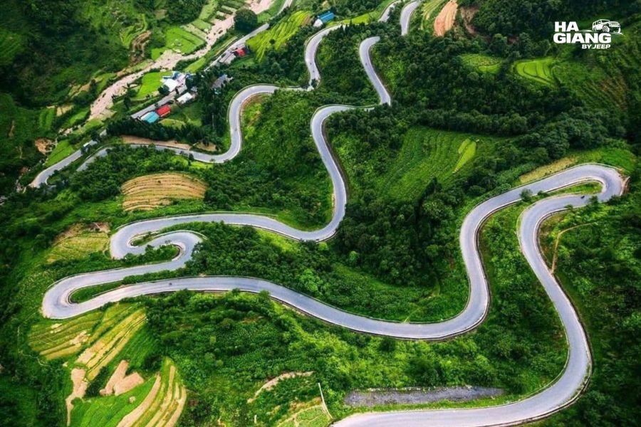
Leave Ha Giang City heading north and the road climbs almost immediately. Within a few kilometres you are on Chin Khoanh Pass, nine bends of switchback rising above a valley that opens out behind you: maize fields, villages below, the city already far away.
It is not the most dramatic pass on the route. Ma Pi Leng has that title without contest. But Chin Khoanh does something that Ma Pi Leng does not. It is the first thing. It is where the plateau starts, where the air changes, and where most travelers look back from the top and understand for the first time what they are actually doing.
What Chin Khoanh Pass Actually Is
Chin Khoanh means nine bends. The road from Ha Giang City to Quan Ba climbs the mountainside through exactly that number of switchbacks, each one delivering a wider view of the valley behind and below.
It sits at the entry point to the Ha Giang highlands. Below the pass is the last of the lowland character of the province. Above it, the landscape shifts: narrower fields, steeper slopes, stone beginning to push through the soil, the air carrying something different.
Most travelers encounter it in the first two or three hours of a trip that begins in Ha Giang City, often without knowing its name. They take the climb, they look back once or twice, and then they keep going north toward Quan Ba and Yen Minh. The pass rarely announces itself.
That is partly what makes it worth understanding in advance. It will pass quickly. The views are there for a few minutes each, not for an hour at a designated stop. Knowing what to look for changes how much you take from it.
The Nine Turns
The switchbacks are not all the same. Some are tight and close the view. Some open it. The best views come on the longer curves where the vehicle slows and the valley behind you spreads out properly.

From a moving vehicle, the most useful position is the one facing back the way you came. As the road curves, the valley behind you does something new on each turn. From the first switchback you see the immediate lower slopes and the road below. By the fourth or fifth you can see how far the valley extends and pick out the town at its base. By the top you have the whole picture.
The pass is not long. The road climbs through the bends at a pace that makes it feel both fast and unhurried, which is the character of a lot of the Ha Giang route. It is not effortful. It simply unfolds.
What You See on the Way Up
The Maize
The valley below Chin Khoanh Pass is planted with corn. In the months before harvest it stands tall and green. At harvest, the slopes are full of the yellow and gold of cut stalks and drying cobs. After harvest, the fields are cut low and the shape of the terracing is visible without the crop to fill it.
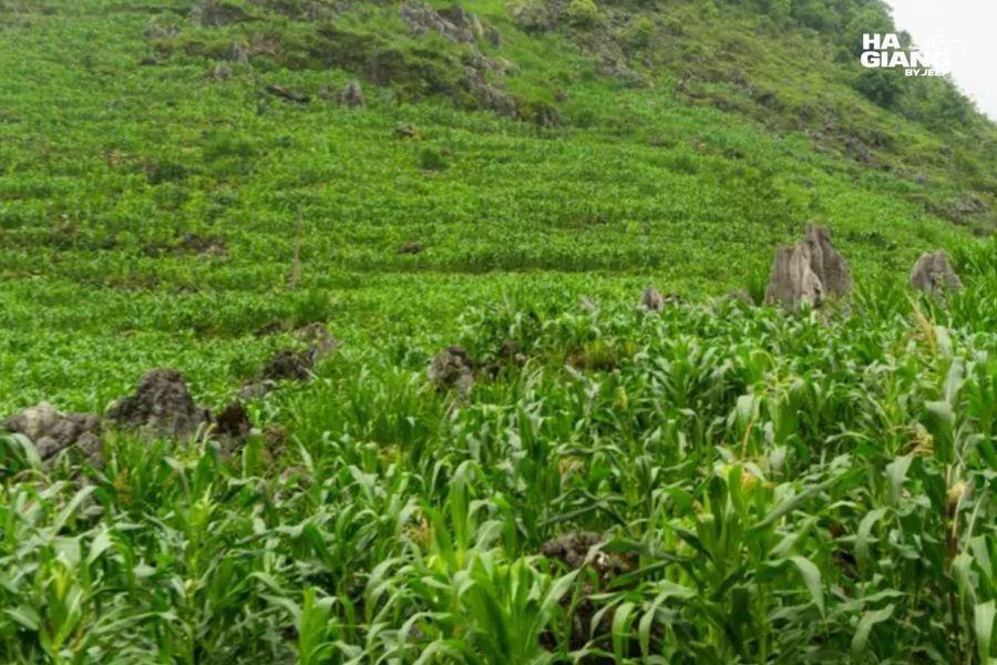
Corn is not a crop that gets photographed much in travel content. Rice terraces are the default northern Vietnam image. But corn here is the staple, and it occupies the landscape in a way that changes completely through the growing season. Driving in late summer or autumn puts you in a particular version of this valley.
The Village Rooftops
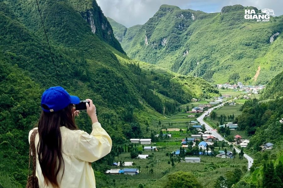
From high enough on the pass, the rooftops of the settlements below become visible. Small clusters, not towns. The spacing tells you something about the terrain and the farming: each house group is near its fields rather than arranged in a pattern that suggests a grid or a centre.
The Road That Continues Below
Looking back, the road you came from is visible for a considerable distance before it disappears into the town. On a clear morning you can trace it a long way back. This is one of the better views on the climb, and it arrives on one of the earlier bends before the road starts to switchback more tightly.
The Viewpoint at the Top
At the highest point of the pass there is a viewpoint that looks both ways: back down the valley you climbed from, and forward toward what lies ahead.
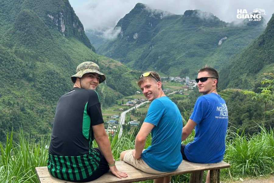
Looking back, the valley of corn and villages opens out in full. On a clear morning this is the fullest version of the view, before the day's heat brings haze.

On a misty morning, which happens often here, the valley can be completely hidden and the pass becomes a road through cloud rather than above it. Frustrating for photographs and very beautiful if you accept the version you got rather than the one you planned for.
Looking forward, the view toward Quan Ba begins to open. The road descends briefly before climbing again, and the shape of the approach to the Twin Mountains at Quan Ba becomes visible on clear days.
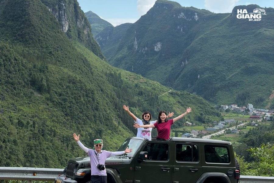
A good driver stops here without being asked, because this is where the trip properly begins. If yours does not, asking is completely reasonable. Five minutes at the top of a pass is not an indulgence. It is the point.
The Valley Below: Corn and What It Means
The relationship between corn and the people of the Ha Giang highlands is worth understanding because it runs through everything you will see for the next several days.
Corn grows in the spaces that rice cannot. On the stone plateau above, rice terraces become rare and eventually disappear. Corn plants itself into every pocket of soil between the rocks, on slopes too steep and too thin for anything else. It is the crop of altitude and adversity, and the Hmong, Dao and other highland communities have grown it on these slopes for generations.

The valley below Chin Khoanh Pass is the lower end of that landscape. Up here the fields are still in valley pockets and on more accessible slopes. As you climb through the pass and continue north, the fields get steeper, narrower, more precarious. By the time you reach the Dong Van Plateau, you are looking at corn planted in soil that seems barely there.
That continuity is not obvious at Chin Khoanh, but it is visible in retrospect at the end of a trip when you look back at what you saw. The pass is the gentle introduction to a landscape that intensifies as you go north.
What Comes After
From the top of Chin Khoanh Pass the road descends briefly into the Quan Ba area, where the terrain changes character. The Twin Mountains, Nui Doi, appear ahead: two almost identical rounded peaks rising from a flat basin. They are visible from several angles as you drive into Quan Ba, and each angle is different.

Above them, Heaven's Gate, Cong Troi Quan Ba, is a viewpoint looking out across the whole valley system. This is the first major stop on most Ha Giang Loop itineraries, and arriving at it feels like a destination after the climb.
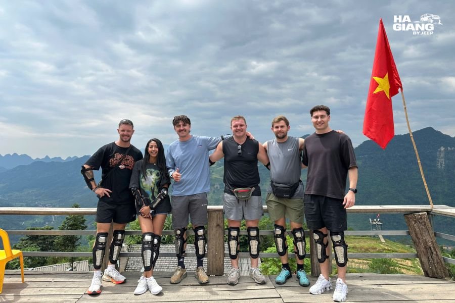
The road then continues north through Yen Minh, through pine forest that looks entirely different from everything before and after it, and eventually onto the Dong Van Karst Plateau itself. Chin Khoanh Pass is already far behind by this point, but the same road that started there runs all the way to Ma Pi Leng and Meo Vac.
See the Ha Giang Loop jeep tours
Photographing Chin Khoanh Pass
The pass is a moving experience rather than a static one, which changes how you photograph it.
The views from Chin Khoanh Pass are sequential: each bend reveals something new and then the road curves again. If you wait for the perfect moment to get out of the vehicle, you will miss most of them. The better approach is to stop two or three times on the way up at bends that particularly open out, and once at the top.
The most useful angles are:
- Looking back down the valley as the road curves. The maize fields spread below, the previous bends of the pass visible in the foreground.
- Looking straight across the valley from the wider curves. On a clear morning this gives the widest horizontal view.
- Looking forward at the road ahead, which shows the remaining bends above you rather than the valley below.
From a private vehicle, none of this requires hurrying. Ask your driver to stop wherever the view opens properly, and he will use his own judgment about which bends are worth the stop. He has driven this pass enough times to know when the light is doing something particular and when it is not.
The pass is short enough that you can also simply sit on the road during a stop and let it go quiet for a moment. In the early morning, before the day's traffic builds, the valley below Chin Khoanh Pass is very still.
Best Time to Drive Chin Khoanh Pass
For the View
Early morning is the most reliable for clarity. Before the day heats up and before road traffic builds, the valley is sharp and the colours are clean. If your itinerary starts from Ha Giang City in the morning, you will reach Chin Khoanh at the right hour without any particular planning.
Late afternoon has good light too, though by then you are usually past this stretch and deeper into the route.
By Season
In the rainy months, roughly June through August, morning mist is common and can close the valley view entirely. That is not a reason to avoid the season, but it is a reason to hold expectations lightly. The same landscape looks completely different through cloud, and many people prefer the mystery of it.
Late autumn, particularly in October and November, brings clear air and the corn harvest. The valley is at its most photogenic in this period, which is also when the wider Ha Giang Loop is at its busiest.
Winter brings cold and sometimes frost at altitude. Chin Khoanh sits lower than the main plateau, so the temperatures are less extreme, but cold morning air at the top of the pass is a real thing, especially in December and January.
Spring, from around March through May, brings clean air and the terraces filling with water before planting. The valley below the pass can look very different in March compared to November.
Our weather by month guide covers what each season actually delivers across the whole route.
Chin Khoanh Pass and the Wider Ha Giang Loop
Chin Khoanh is not one of the stops that sells the trip. When people describe Ha Giang to someone who has not been, they mention Ma Pi Leng. They mention Dong Van Old Quarter. They mention the buckwheat flowers on the plateau or the boat trip through Tu San Canyon.
Chin Khoanh is the transition between the ordinary roads of the provincial capital and the landscape that makes all of those things possible. It is where the trip starts being a trip rather than a journey out of town.
Every pass on the Ha Giang route has a character. Bac Sum Pass, just before Chin Khoanh, is a sharper climb with a dramatic sudden view. Chin Khoanh is longer and more gradual, with the view building across nine bends rather than arriving all at once. Ma Pi Leng, the climax of the route, is on an entirely different scale.
Understanding how they relate to each other is part of what makes the route make sense as a whole rather than a series of unconnected viewpoints.
A private vehicle changes all of this because you stop when it is worth stopping rather than when the schedule allows. Nine turns go by quickly in a vehicle that does not stop. They go by at a completely different pace in one that does.
Which Jeep Tour Is Right for You?
Chin Khoanh Pass is on every Ha Giang Loop itinerary because it sits on the only road north out of Ha Giang City.
Ha Giang Loop, 3 days the classic route starting with Chin Khoanh and Quan Ba on the first morning, covering the plateau and Ma Pi Leng across three days.
Ha Giang Loop, 4 days the same route with more time at each stop. The first morning is slower, which means Chin Khoanh and the Quan Ba valley get longer.
Ha Giang and Cao Bang, 5 days starts the same way and continues east from the Loop into Cao Bang and Ban Gioc Waterfall.
Ha Giang and Cao Bang, 6 days the full northeast, with Chin Khoanh on the first morning and six days of road ahead.
Jeep Wrangler Rubicon rental if you want to drive the nine turns yourself.
With a private vehicle, you ask the driver to stop at any bend that looks worth stopping at, and he will. Chin Khoanh is short. The viewpoints on it are brief. But brief moments viewed from a stopped vehicle are different from brief moments viewed through a window at speed.
With your own driver, every stop on the pass is possible. With corn wine at the homestay that night, you can look back on the day and know you caught all of it.
Questions? Contact us or message +84 938 988 593 on WhatsApp.
Frequently Asked Questions
Chin Khoanh Pass is the first significant mountain climb on the Ha Giang Loop, just north of Ha Giang City on the road toward Quan Ba. Its name means nine bends, referring to the nine switchbacks that carry the road up the mountainside above a wide valley of maize fields.
Yes. It sits on the only road north from Ha Giang City, so every Loop itinerary passes through it. Most travelers encounter it in the first few hours of the trip.
The road is paved and well maintained. The passes here are challenging in the sense that mountain roads with switchbacks always are, but they are not technically extreme. A driver who travels these roads regularly is the best preparation.
Yes, at the highest point of the pass. It looks back down the valley toward Ha Giang City and forward toward the Quan Ba basin. A good driver stops here; if yours does not, asking is completely reasonable.
They are different in scale and character. Ma Pi Leng is the dramatic centrepiece of the route, cutting along a cliff face above the Nho Que River. Chin Khoanh is the opening climb, longer and more gradual, with the valley view building across nine bends. They are not really comparable, which is partly the point of doing the whole route.
The road remains open in the rainy season but can have mist and reduced visibility, and road conditions depend on rainfall. Confirm current conditions close to your travel dates.
The road descends toward Quan Ba, where the Twin Mountains, Nui Doi, and Heaven's Gate viewpoint are the first major stops on the standard Loop itinerary.
You could walk parts of it, but it is a road rather than a trail. The experience most visitors have is by vehicle, stopping at viewpoints on the way up and at the top.
Ha Giang by Jeep runs private 4x4 tours across the Dong Van Karst Plateau and Non Nuoc Cao Bang Geoparks, with English speaking local drivers and 24/7 support from our office in Ha Giang City. Email booking@hagiangbyjeep.com or WhatsApp +84 862 379 288.