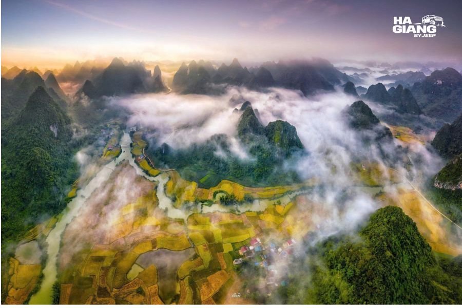
Quay Son River: Cao Bang's Emerald Water
The first time you see the Quay Son River, you will probably assume the photo you saw beforehand was edited. It was not.
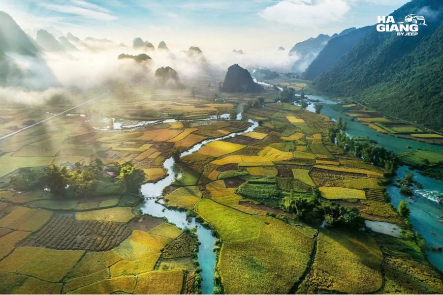
On a good morning in Trung Khanh the water is a flat jade green, the kind of colour that looks wrong next to the brown rivers most travelers have seen elsewhere in Vietnam, and it runs through a valley so flat and so green that the limestone peaks around it look like they were dropped in afterwards.
This guide covers the river end to end from a traveler's point of view: what it is, why it turns that colour, when it does and does not, which stretches are worth stopping at, and how to build it into a trip that comes over from Ha Giang rather than flying in and out of Cao Bang.
What is in this guide
- What the Quay Son River actually is
- Why the water is that colour
- When the emerald green shows up
- Phong Nam Valley: the postcard stretch
- Ngoc Con and Ngoc Khe: the quiet middle
- Where the river becomes Ban Gioc
- Bamboo rafts and getting on the water
- God's Eye Mountain and what else is close
- How the river fits a Ha Giang to Cao Bang route
- Photography notes that actually help
- Practical things worth knowing before you go
- Which jeep tour suits you best
- FAQ
What the Quay Son River Actually Is
The Quay Son River is a river in Trung Khanh district, Cao Bang province, in the far northeast of Vietnam. It crosses in from China, runs through a series of wide farming valleys, and then drops over a limestone shelf to form Ban Gioc Waterfall on the border between the two countries.
Most travelers meet it backwards. They come to Cao Bang for Ban Gioc, see the waterfall, and only afterwards realise the river above and below it is the more interesting thing. The falls are the famous photograph. The river is the day.
Two things make it unusual for visitors:
- It runs through flat, open valleys. Northern Vietnam is mostly steep. Here the land opens out into a broad floor of rice and corn with karst towers standing around the edges, which is why the scenery photographs so differently from Ha Giang.
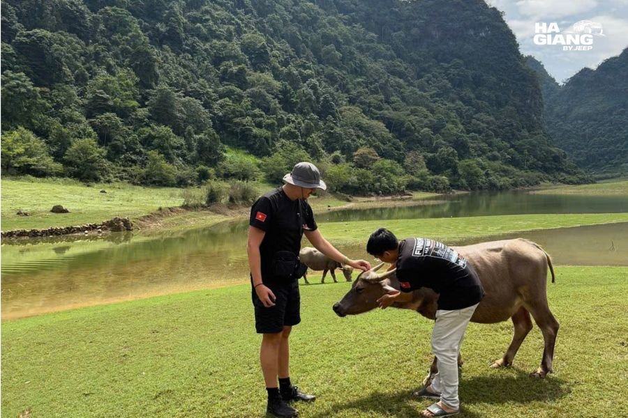
- It is a working river, not an attraction. Buffalo stand in it. People fish in it, wash in it, and farm right up to the bank. There is no gate, no ticket booth, and no viewing platform on most of its length. You simply arrive at a bend in the road and there it is.
That last point shapes how you should plan. The good parts of the Quay Son are not marked on a map with a name and an entrance. They are stretches of road, and you need to be able to stop at them.
Why the Water Is That Colour
The short version: limestone.
The whole region sits inside the Non Nuoc Cao Bang UNESCO Global Geopark, which is karst country. Water moving through limestone picks up dissolved minerals, and fine suspended particles scatter light in a way that reads as green or turquoise to the eye. It is the same reason certain rivers and lakes in limestone regions elsewhere in the world look artificially blue.
The colour is not constant, and this is the part travelers get wrong. It is a property of the water on that particular day, not a permanent feature of the river. Heavy rain upstream washes sediment in and the whole thing turns milky brown within hours. A week of dry, settled weather and it goes back to jade.
Nobody can promise you the emerald version. Any guide, blog or agency that guarantees it is guessing.
When the Emerald Green Shows Up
Here is honest seasonal guidance rather than a promise.
| Period | River colour | Landscape | Notes |
|---|---|---|---|
| Roughly Sep to Nov | Usually at its clearest | Rice turning gold, then harvested | The window most photographers aim for |
| Roughly Dec to Feb | Often clear, lower water | Bare fields, cold, mist common | Quiet, atmospheric, waterfall less powerful |
| Roughly Mar to May | Variable | Fields green and growing | Pleasant, fewer visitors than autumn |
| Roughly Jun to Aug | Often brown after rain | Very green, waterfall at its fullest | Trade off: big waterfall, murky river |
The pattern behind that table is simple. The river is clearest when it has not rained hard recently. The waterfall is most impressive when it has. You rarely get both at their best on the same day, and choosing which one matters more to you is a real decision worth making before you book.
Weather in this region does not follow the calendar politely. A dry October week and a wet October week both happen. Check current conditions close to your travel date rather than trusting a seasonal chart, including this one.
Ask us what the water is doing right now
We are based in Ha Giang and run this route constantly. Tell us your dates and we will tell you honestly what the river has looked like recently and whether it is worth reshuffling a day.
WhatsApp us See the 5 Days Cao Bang tripPhong Nam Valley: The Postcard Stretch
If you only stop once on the Quay Son River, stop here.
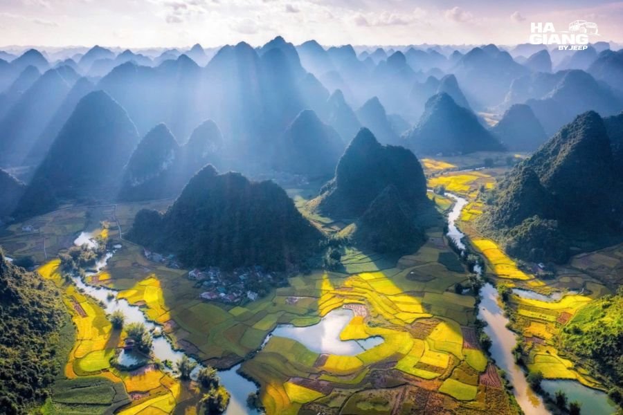
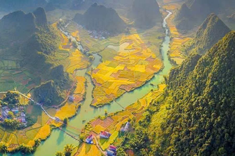
Phong Nam is a farming valley where the river bends through the middle of the fields with karst peaks standing on every side. There is a small village, a bridge, a scattering of stilt houses, and almost nothing built for tourism. The scene changes completely depending on where the rice is in its cycle: bright green in growth, gold before harvest, brown stubble and open water afterwards.
What to do there:
- Walk the lanes between the fields. The valley floor is flat, which makes it one of the few genuinely easy walks in the region for travelers who do not want a hike.
- Find the bend. The classic view is from slightly above the valley floor looking down at the curve of the river. Your driver knows the pull in.
- Sit still for twenty minutes. This sounds like filler advice. It is not. Phong Nam rewards waiting more than it rewards walking. Light shifts, buffalo cross, a boat goes past.
For older travelers and families this is one of the best value stops on the whole Ha Giang to Cao Bang route, because the scenery is genuinely spectacular and the physical effort involved is close to zero.
Ngoc Con and Ngoc Khe: The Quiet Middle
Between Phong Nam and Ban Gioc the river runs through Ngoc Con and Ngoc Khe. This stretch gets a fraction of the visitors, partly because there is no single famous viewpoint to aim a car at.
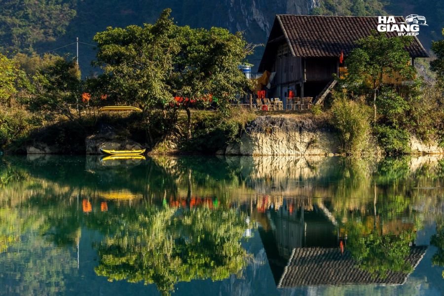
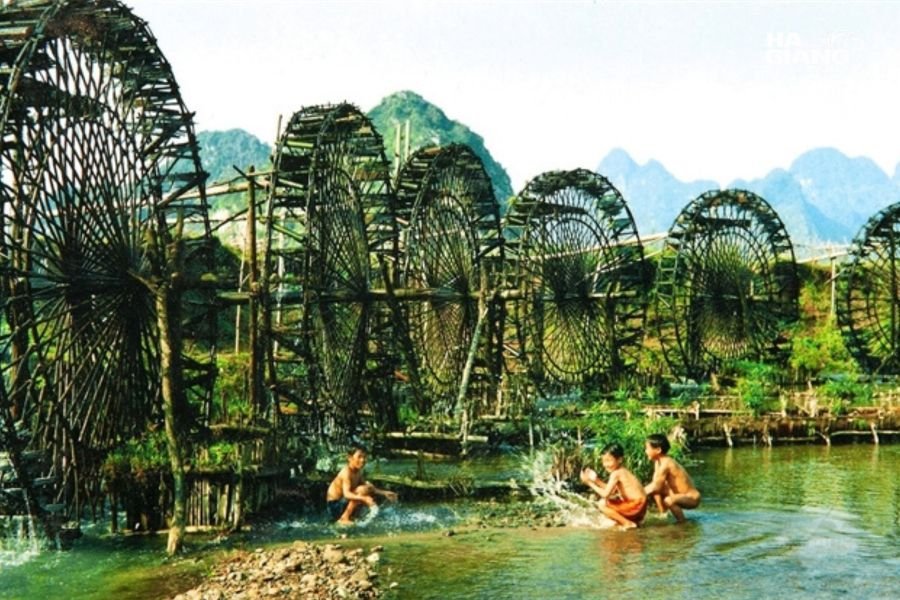
What you get instead is ordinary life along a beautiful river. Water wheels and irrigation channels feeding the fields. Ducks. Someone fixing a net. Old stone houses that have clearly been there a very long time. Ngoc Con Valley in particular is worth a slow drive with the roof open rather than a single stop and a photograph.
This is where a private vehicle earns its money. There is no bus that stops here, no organised tour that pauses here, and no way to know in advance which bend will be the one that stops you. You need to be in something that can pull over on a whim, at a spot nobody wrote down.
Where the River Becomes Ban Gioc
Downstream, the valley narrows and the Quay Son drops over a wide limestone step. That is Ban Gioc Waterfall, and it sits directly on the border between Vietnam and China.
A few things worth understanding about the river at this point:
- It is a border river here. The frontier runs through the water. There are rules about where boats can go and where you can stand, and those rules are set by the authorities, not by tour operators.
- Volume changes everything. After heavy rain the falls are wide, loud and brown. In the dry months they are gentler, clearer and split into more separate strands. Both are worth seeing. They are not the same experience.
- Above the falls is calm. The stretch of river immediately upstream is flat and quiet, which surprises people who only know the waterfall photograph.
Entrance arrangements, ticketing, boat operating rules and border regulations can all change. We do not publish those details because they go out of date and a wrong number in a blog post is worse than no number. Confirm current arrangements with your driver or with us before the day.
Bamboo Rafts and Getting on the Water
Raft trips operate near Ban Gioc, taking visitors out from the Vietnamese bank toward the base of the falls. It is a short ride rather than a river journey, and the appeal is the angle: from the water you get the scale of the thing in a way you cannot from the bank.
Practical notes, kept general on purpose:
- Expect to get wet. Spray carries a long way, especially when the water is high. Put anything electronic in a dry bag.
- Wear something with grip. Boarding is done from a wet bank onto a wet platform.
- Operations are weather dependent. When the river runs high and fast, rafts may not run at all. That decision is made locally on the day.
- Prices and operating hours change. Ask on the ground. We will not quote a figure we cannot stand behind.
Elsewhere along the Quay Son, swimming happens locally in the calmer stretches in summer. Currents in a river fed by upstream rain are not always visible from the bank, so if you go in, go in where local people are already in, and not after heavy rain.
God's Eye Mountain and What Else Is Close
The Quay Son is the spine of a day, not the whole of it. Everything below is within reasonable reach and works naturally around the river.
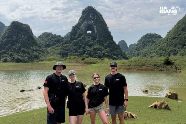
God's Eye Mountain. A limestone peak with a natural hole punched clean through it, sitting above open grazing land and seasonal water. It photographs best in soft light and it is one of the most distinctive shapes in the whole Geopark.
Nguom Ngao Cave. A large limestone cave system near Ban Gioc. Cool inside, lit, and a good option for the hottest part of the afternoon or for a rainy hour.
Truc Lam Phat Tich Pagoda. On the hillside above Ban Gioc, with a long view back down the valley. Worth it for the vantage point alone.
Pac Bo Historical Site. Further west, and a different kind of stop, historical rather than scenic. Usually slotted in on the way in or out rather than on a river day.
Khau Coc Cha, the 15 step pass. Not on the Quay Son at all, but on the road between Ha Giang and Cao Bang near Bao Lac. A series of stacked switchbacks that is a genuine highlight of the drive over. It only appears on itineraries that travel between the two provinces by road.
That last one is the argument for the longer combo itineraries. Fly or bus straight into Cao Bang and you get the river. Drive over from Ha Giang and you get the river plus the entire crossing.
How the River Fits a Ha Giang to Cao Bang Route
Most travelers arrive in this region for the Ha Giang Loop. Cao Bang gets added on afterwards, and the Quay Son River is one of the main reasons it is worth adding.
The rough shape of a combined trip:
- Start in Ha Giang City. The Loop first: Quan Ba, Yen Minh, Dong Van, Ma Pi Leng, Meo Vac.
- Cross east toward Cao Bang. This is the Bao Lac direction, and where Khau Coc Cha sits.
- Reach Trung Khanh and the Quay Son valleys. Phong Nam, Ngoc Con, Ngoc Khe.
- Ban Gioc and the surrounding sites. Waterfall, cave, pagoda.
- Finish in Cao Bang City and travel onward from there.
Two practical points about this shape.
You end in Cao Bang, not back in Ha Giang. That matters for onward travel. Combo trips are picked up to Ha Giang at the start and returned from Cao Bang at the end. There is no transfer that takes you directly to Cao Bang at the beginning, so plan your arrival into Ha Giang.
The extra day is what buys you the river. On a tight schedule the Quay Son becomes a drive past on the way to the waterfall. With one more day it becomes a morning in Phong Nam, a slow run through Ngoc Con, and time at the falls without watching the clock. That difference is essentially the difference between the 5 days and 6 days itineraries.
Photography Notes That Actually Help
- Morning beats afternoon in the valleys. Phong Nam faces the light better early, and mist sitting on the fields is a common early morning bonus in the cooler months.
- Green water needs a high angle. Photographed level with the surface, the river reflects the sky and reads grey or blue. Photographed from above, you see through it and the green appears. Height is the whole trick.
- A polariser is the one filter worth carrying. It cuts surface reflection, which is exactly what is hiding the colour.
- The waterfall is a backlight problem in the afternoon. Plan the falls for the earlier part of the day if the photograph matters to you.
- Ask before photographing people. Farming families along this river are going about their day, not posing. A gesture toward the camera and a nod back is all it takes, and it is not always yes.
- Drone rules change and vary by area. This is a border region. Do not assume, and do not rely on what a blog told you last year. Check current regulations locally before flying anything.
The unglamorous advantage of travelling by jeep here is boring and real: your camera bag sits on a seat instead of on your back, it stays dry when the weather turns, and the vehicle stops the moment the light does something interesting.
Practical Things Worth Knowing Before You Go
Distances feel longer than they look. Mountain roads, villages, and livestock all slow things down. A short distance on a map is not a short drive.
There is very little tourist infrastructure along the river. Bring water. Toilets are in villages and at the Ban Gioc site, not between them.
Weather turns fast. Sun to heavy rain in twenty minutes is normal here. A vehicle with a roof and heating changes what a wet afternoon feels like.
Border areas have their own rules. Permits and access arrangements in frontier zones exist and can change. Handling that paperwork is part of what an operator based here does. Do not improvise it.
Cash is useful. Small villages, small purchases, and card acceptance is thin outside towns.
Nothing here needs to be rushed. The single most common regret travelers report on this route is booking too short a trip and spending it in transit. The valleys reward slowness more than any other part of northern Vietnam.
Which Jeep Tour Suits You Best
| Option | Includes the Quay Son? | Best for |
|---|---|---|
| 3 Days 2 Nights Loop | No, Ha Giang only | Short trips, the core Loop, Ma Pi Leng and Dong Van |
| 4 Days 3 Nights Loop | No, Ha Giang only | A fuller Ha Giang Loop with more villages and a slower pace |
| 5 Days 4 Nights to Cao Bang | Yes | Travelers who want the Loop plus Ban Gioc and the river |
| 6 Days 5 Nights to Cao Bang | Yes, with real time in the valleys | The unhurried version, morning in Phong Nam, extra sites |
| Jeep Wrangler Rubicon rental | Your route, your call | Confident self drivers who want full freedom |
If the Quay Son River is the reason you are coming, take a combo itinerary rather than the Loop alone. The river is in Cao Bang province, and no Ha Giang only route reaches it.
Between the two combo lengths, the honest split is this: five days gets you there and gets you the waterfall properly. Six days gets you the mornings, and the mornings are when this river looks like the photographs.
Plan the Cao Bang leg with people who drive it every week
Send us your dates and what you care about most, the river or the waterfall, and we will tell you which itinerary fits and what the conditions have been like. Once your dates are confirmed, book early. Jeep availability is limited and most guests book 1 to 3 months ahead.
WhatsApp us Book now ContactFrequently Asked Questions
Where is the Quay Son River?
It is in Trung Khanh district, Cao Bang province, in the far northeast of Vietnam. It enters from China, runs through several farming valleys, and forms Ban Gioc Waterfall on the border.
Why is the Quay Son River green?
The region is limestone karst, part of the Non Nuoc Cao Bang UNESCO Global Geopark. Minerals and fine particles carried by water moving through limestone scatter light and give the river its jade colour.
When is the best time to see the emerald water?
Roughly September to November is the window most people aim for, when rain has eased and the fields are turning gold. The colour depends on recent rainfall rather than the calendar, so check conditions close to your dates.
Is the river always that colour?
No. Heavy rain upstream turns it brown within hours. Anyone guaranteeing emerald water on a specific date is guessing.
Can you swim in the Quay Son River?
Local people swim in calmer stretches during the warm months. Currents are not always visible from the bank, so only enter where locals are already swimming, and not after heavy rain.
How far is the Quay Son River from Ha Giang?
It is in a different province, reached by driving east through the Bao Lac direction. It appears only on combined Ha Giang and Cao Bang itineraries, not on Ha Giang Loop tours.
What is the best viewpoint on the river?
Phong Nam Valley is the one most travelers choose, with the river curving through flat rice fields between karst peaks. Ngoc Con and Ngoc Khe are quieter and better for a slow drive than for a single stop.
Do I need a permit to visit?
Parts of this region are border areas with their own access arrangements, and rules can change. An operator based in the region handles this, and you should confirm current requirements before travelling rather than relying on older information.
Can I fly a drone over the Quay Son River?
Drone regulations vary by area and change over time, and this is a border region. Check the current rules locally before flying, and do not assume permission based on what other travelers did previously.
Is Ban Gioc the same thing as the Quay Son River?
Ban Gioc is the waterfall the river forms where it drops over a limestone shelf. The Quay Son is the whole river, and most of its best scenery is upstream of the falls.
Is this suitable for older travelers or families?
Yes. The valley floors are flat, the main viewpoints are close to where a vehicle can stop, and a private jeep removes the need to walk long distances between sites.
How many days do I need for Cao Bang?
Two full days in the Cao Bang section covers the river, the waterfall and the nearby sites without rushing, which is what the 6 days combo itinerary is built around. Five days covers the highlights at a faster pace.