Phong Nam Valley: Cao Bang's Quiet Corner Near Ban Gioc
Most people arrive at Phong Nam Valley by accident. They came to Cao Bang for Ban Gioc Waterfall, the road passed through a wide flat valley of rice and stilt houses with limestone towers standing around the edges, and somebody said stop.
That is how this place works. It is not an attraction. There is no gate, no ticket, no viewing platform, no sign telling you where to stand. It is farmland where people live, and it happens to be one of the most photogenic pieces of countryside in northern Vietnam.
This guide covers what the valley is, what there is to do beyond looking at it, when the scenery is at its best, and how to fit it into a trip that comes across from Ha Giang rather than flying in and out of Cao Bang.

What is in this guide
- What Phong Nam Valley is
- Why it looks different from the rest of the north
- The village and its houses
- What there is to do
- Walking the valley
- When to go
- The river through it
- Staying overnight
- Photography notes
- Visiting without making it worse
- What is nearby
- Which jeep tour suits you best
- FAQ
What Phong Nam Valley Is
Phong Nam is a farming valley in the Trung Khanh area of Cao Bang province, in the far northeast of Vietnam, not far from Ban Gioc Waterfall. It sits inside the Non Nuoc Cao Bang UNESCO Global Geopark.
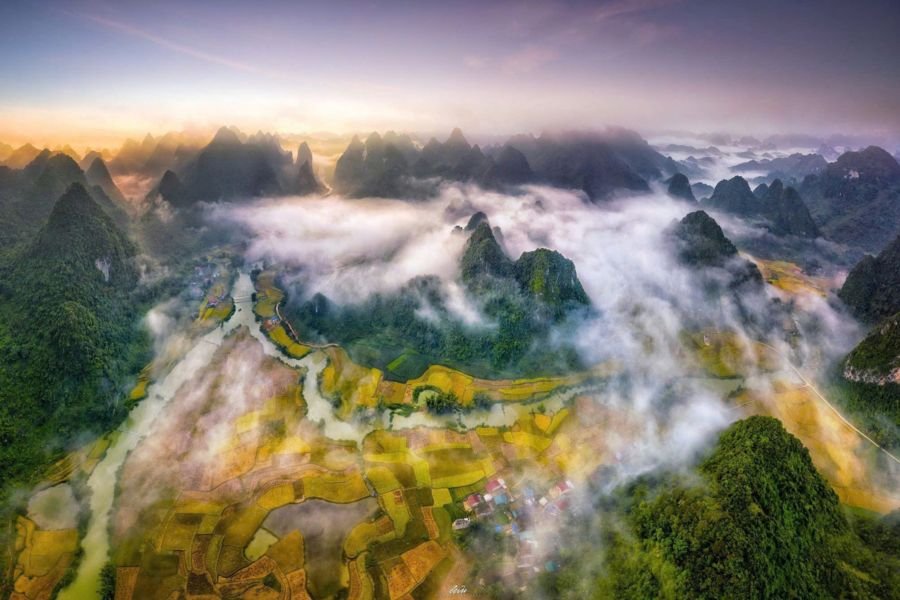
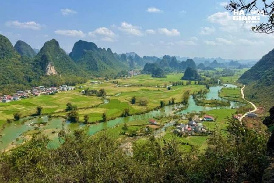
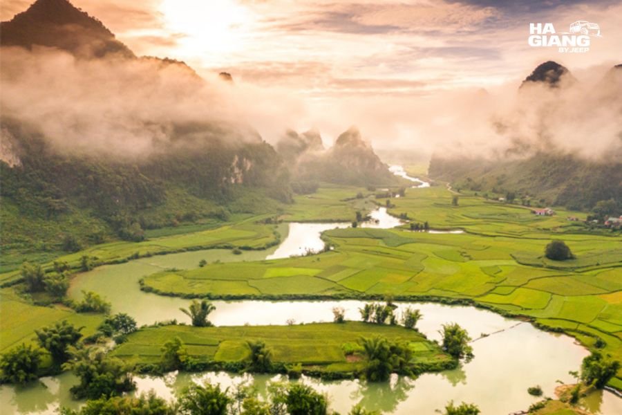
The shape of the place is what makes it. A flat valley floor of rice and corn, maybe a couple of kilometres across, entirely enclosed by limestone karst towers that rise straight out of the fields with no foothills in between. A river runs through the middle of it. A village of wooden stilt houses sits on the flat ground with the fields worked right up to the doorsteps.
Who lives there. The valley is home to Tay communities, and the architecture reflects that. These are working farms, not a preserved village.
What it is not. It is not a tourist site. There is no ticket office, no organised tour of the village, no craft demonstration laid on for visitors. A few homestays operate and a few small shops sell drinks. Beyond that, it is a place where people farm.
That is the whole appeal, and it is also the thing that makes visiting a slightly different exercise from visiting a waterfall. There is nothing to see in the sense of a marked attraction. There is a great deal to look at.
Why It Looks Different From the Rest of the North
Travelers arriving from Ha Giang notice this immediately.
Ha Giang is vertical. Roads climb, villages cling to slopes, terraces stack up hillsides, and you are almost always looking either up or down. The scale is enormous and the ground is rarely flat.
Cao Bang around Phong Nam is horizontal. The valley floors are genuinely flat, wide, and green, with the karst towers standing on them like objects placed on a table rather than like the sides of a mountain range.
Why the geology does that. This is tower karst, limestone eroded over an extremely long time until what remains are isolated peaks standing on a flat plain. The technical detail is a Geopark matter rather than a jeep company matter, and there is interpretive material available locally if it interests you.
Why it matters to you as a traveler. Flat ground means you can actually walk here. After several days in Ha Giang where every stop involves a slope, a valley you can stroll across is a genuine relief, particularly for families and for travelers who are not looking for a hike.
The Village and Its Houses
The stilt houses are the thing most visitors photograph, and it is worth knowing what you are looking at.
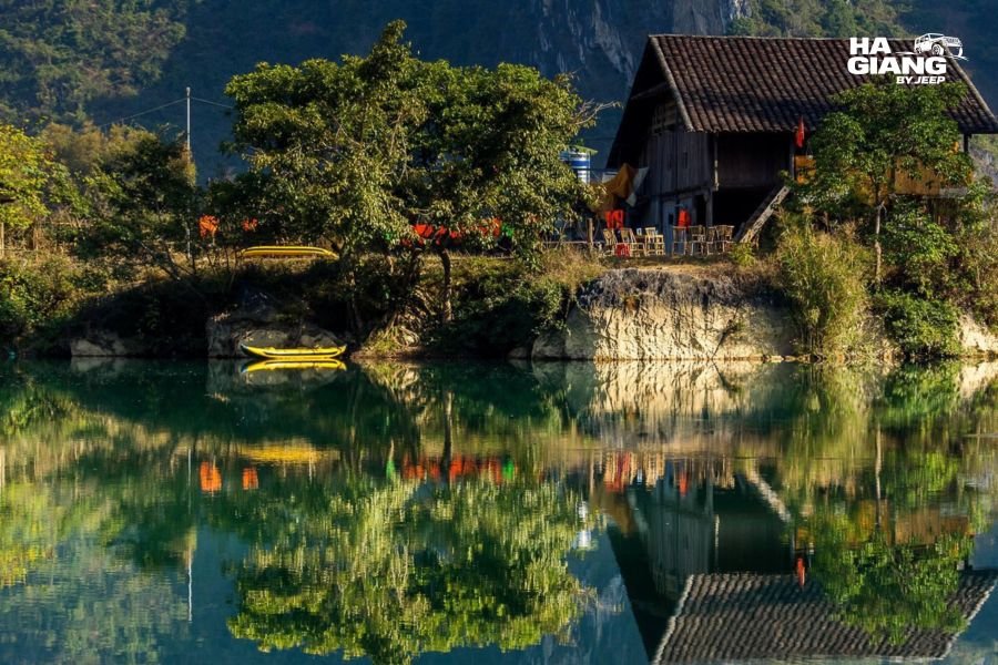
Traditional Tay stilt houses are built on wooden posts with the living space raised above ground level, dark tiled roofs, and wooden walls. The space underneath was traditionally used for storage and livestock. Many are old. Some are very old.
They are lived in. People are cooking in them, drying corn under them, and keeping animals around them. This is not a heritage village where the houses are exhibits.
Newer buildings are mixed in. Concrete houses stand alongside wooden ones, because families build what they can afford and what suits them. Travelers sometimes express disappointment about this, which is an unattractive thing to express. Nobody owes a visitor a picturesque house.
Watch the details rather than the postcard. Corn hanging to dry under the eaves. Water channels running between fields. A buffalo tied in the shade. Someone repairing a net. The valley rewards noticing more than it rewards photographing.
Cao Bang is the half of the trip most people skip
Phong Nam only appears on itineraries that continue east from Ha Giang. Tell us your dates and we will tell you honestly whether you have the days for it.
WhatsApp us See the 5 Days Cao Bang tripWhat There Is to Do
Honest answer first: not very much, and that is the point. Here is what people actually do.
- Walk. Covered properly in the next section. The single best use of time here.
- Cycle. Bicycles can sometimes be arranged through homestays. The flat valley floor makes this genuinely easy, unlike almost anywhere in Ha Giang.
- Sit somewhere and wait for the light. Not filler advice. Phong Nam changes completely between morning mist, midday flatness and late afternoon gold. An hour spent in one spot gets you more than three hours of driving around.
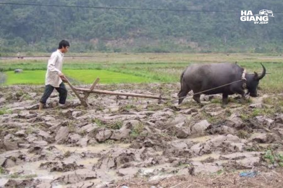
- Watch farming. Depending on the season: ploughing, planting, weeding, harvesting, threshing. All of it happens in the open, right beside the path.
- Swim or paddle in the river, in the calmer stretches, in the warm months, where local people are already in the water. Not after heavy rain.
- Eat. Homestays cook, and it is home cooking rather than restaurant food.
- Talk to people. With a driver who speaks the language this stops being aspirational and becomes something that actually happens.
What you should not expect: activities, attractions, entertainment, or anything organised. If your travel style needs a schedule of things to do, budget an hour here rather than a day.
Walking the Valley
This is the reason to give Phong Nam more than a photo stop.
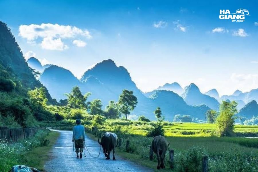
The ground is flat. Genuinely flat. Paths run between the fields and along the river, and you can walk for an hour or two without a climb. In a region defined by mountains this is unusual and it makes the valley accessible to people who cannot or do not want to hike.
There is no marked trail, and you do not need one. The valley is small enough to see across, the karst towers give you constant reference points, and the paths connect. Getting lost in a meaningful sense is difficult.
Some rough guidance on where to go:
- Along the river for the classic views back across the fields toward the houses
- Through the village slowly, on the lanes rather than through anyone's yard
- Toward the edge of the valley where the flat ground meets the base of the towers, for the view back across everything
- Up any small rise you can find, because a little height transforms the photograph completely
Practical notes. Paths between paddies are narrow and can be muddy or slippery, especially after rain. Field boundaries are people's property, so stay on paths rather than cutting across planted ground. Bring water, since there is not much sold in the valley. There is very little shade in the middle of the day.
Ask before entering anywhere that looks private, which includes yards, the space under houses, and anything with a gate.
When to Go
The valley changes completely with the farming calendar, and there is no single best time. There is a best time for the thing you want.
| Period | The fields | Notes |
|---|---|---|
| Roughly Sep to Nov | Rice turning gold, then harvested | The classic photography window, drier weather, river usually clearest |
| Roughly Dec to Feb | Bare fields and stubble, mist common | Cold, quiet, atmospheric, very few visitors |
| Roughly Mar to May | Ploughing, flooded paddies, then bright green shoots | Reflections in the water, active farming, pleasant temperatures |
| Roughly Jun to Aug | Deep green, tall rice | Hot and wet, river often brown, waterfall at its fullest |
Two things worth understanding. The gold rice window that everyone photographs is short, moves depending on the season, and is not the same date every year. And the trade off between a clear green river and a full powerful waterfall is real: the river is clearest when it has not rained recently, and Ban Gioc is most impressive when it has.
Ask close to your dates rather than planning from a chart, including this one. Farming calendars shift with the weather and we would rather tell you what the fields are actually doing than have you arrive expecting gold and find stubble.
Time of day matters more than most people expect. Early morning gives you mist in the fields and soft light on the houses. Late afternoon gives you gold on the karst. The middle of the day is flat, hot and the least rewarding time to be here.
The River Through It
The river running through Phong Nam is the Quay Son, and it is the same water that drops over the limestone shelf downstream to form Ban Gioc Waterfall.
- The colour comes and goes. In settled dry weather it runs a clear jade green. After heavy rain upstream it turns brown within hours. Nobody can promise you the green version on a given date.
- It is a working river. Buffalo stand in it, people wash and fish in it, and water is channelled off it into the fields.
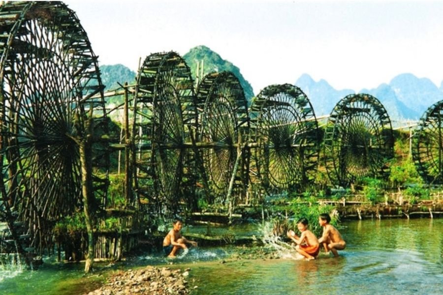
- The old water wheels you see along this stretch and around neighbouring Ngoc Con are irrigation, lifting water into the channels that feed the paddies.
The river gets its own full treatment in our Quay Son River guide, including the other valleys it runs through and where it becomes Ban Gioc. Here it is simply the thing running through the middle of the view.
Staying Overnight
Homestays operate in Phong Nam, run by families in the valley, and staying is a very different experience from stopping.
What staying gets you. The valley in early morning, which is when it is at its best and when day visitors are not there. Dinner cooked by the family. An evening that is genuinely quiet.
What to expect from the accommodation. Simple. Often shared or basic sleeping arrangements, sometimes private rooms, home cooking, and facilities that are functional rather than hotel standard. This is a farming valley, not a resort area.
We are not going to publish prices, room types or specific names. Homestay operations here open, close and change hands, and details go stale. Availability and standards vary a great deal between houses. Ask us or ask your driver close to your dates and you will get current information rather than something written a year ago.
Book ahead in the busy periods, particularly around the harvest photography window and Vietnamese public holidays, when domestic visitors fill the valley.
A realistic note. Most itineraries base in Cao Bang City or near Ban Gioc and visit Phong Nam during the day. Staying in the valley itself is the better experience and the less convenient one. Which of those matters more is a decision worth making deliberately rather than by default.
Photography Notes
- Height changes everything. Shot from the valley floor, the fields and the river flatten out. From even a small rise, the whole composition of river, fields, houses and towers assembles itself. Find any elevation you can.
- Morning for mist, evening for gold. Mist sitting in the fields in the cooler months is the shot people come back with. Late light on the karst is the other one.
- A polariser helps with the river, cutting the surface reflection that hides the green.
- Include something for scale. The karst towers do not read as large in a photograph without a house, a buffalo or a person somewhere in the frame.
- Ask before photographing people. Farming families here are working, not posing for anyone. Chụp ảnh được không, roughly choop ang duc khom, takes two seconds and changes the interaction completely. Accept a no cheerfully.
- Do not photograph inside houses or under them without being invited. The space under a stilt house is part of the home.
- Drone rules vary by area and change, and this is a region near a border. Check current regulations locally before flying, and do not rely on what another traveler did last year.
Visiting Without Making It Worse
Phong Nam is at the stage a lot of beautiful places pass through: known enough to get visitors, small enough that visitors are noticeable.
- Stay on paths. Planted fields are somebody's income. A path through the middle of a rice paddy for a photograph is a real cost to a real family.
- Do not fly a drone low over houses. Legal or not, it is intrusive.
- Spend money in the valley. Drinks from the shop, lunch at a homestay, a night's stay. Tourism that leaves no money behind is the version communities end up resenting.
- Keep noise down. This is where people live, and a valley carries sound.
- Take your rubbish with you. Waste collection in a rural valley is not what you are used to at home.
- Do not give money or sweets to children. It is well meant and it creates a dynamic nobody involved benefits from. If you want to give something, spend it with the adults running businesses.
- Ask before entering anywhere. Yards, houses, workshops, anywhere with a gate.
None of this is complicated. It amounts to behaving the way you would if you found yourself walking through farmland at home.
What Is Nearby
Phong Nam works as part of a Cao Bang day rather than as a destination on its own.
Ban Gioc Waterfall. The reason most people are in this part of the province, downstream on the same river, sitting on the border with China.
Ngoc Con and Ngoc Khe. The quieter valleys along the same river, with fewer visitors and no single famous viewpoint, best experienced as a slow drive.
Nguom Ngao Cave. A large limestone cave system near Ban Gioc. A good option for the hottest part of an afternoon or a wet hour.
Truc Lam Phat Tich Pagoda. On the hillside above Ban Gioc, with a long view back down the valley.
God's Eye Mountain. A limestone peak with a natural hole punched through it, one of the most distinctive shapes in the Geopark.
Pac Bo Historical Site. Further west, historical rather than scenic, usually fitted in on the way in or out.
Khau Coc Cha, the 15 step pass. Not in Cao Bang's east at all, but on the road over from Ha Giang near Bao Lac. Stacked switchbacks that are a highlight of the drive between the two provinces, and only on the itinerary if you travel between them by road.
Which Jeep Tour Suits You Best
The blunt fact about Phong Nam is that no Ha Giang Loop itinerary reaches it. The valley is in Cao Bang province, and getting there means the combo route.
| Option | Reaches Phong Nam? | Best for |
|---|---|---|
| 3 Days 2 Nights Loop | No, Ha Giang only | Short trips, Ma Pi Leng and Dong Van |
| 4 Days 3 Nights Loop | No, Ha Giang only | A fuller Loop with more villages and a slower pace |
| 5 Days 4 Nights to Cao Bang | Yes, usually as a stop on the Ban Gioc day | Travelers who want the Loop plus Cao Bang |
| 6 Days 5 Nights to Cao Bang | Yes, with time to walk it properly | The unhurried version across two Geoparks |
| Jeep Wrangler Rubicon rental | Your route, your call | Confident self drivers |
The five versus six days question, answered honestly. Five days gets you to Phong Nam and gives you a stop there, probably an hour, probably in the middle of the day on the way to or from the waterfall. Six days gives you a morning: mist, soft light, a walk across the valley, and time to sit still. Everything this guide recommends doing here needs the second version.
Why a vehicle that stops matters here specifically. The good views in this valley are not at a marked viewpoint. They are at a bend, a gap in the houses, a rise beside the road that you see two seconds before you pass it. Being able to stop on the spot, put the bag down, and walk fifty metres is the entire difference between seeing Phong Nam and driving through it.
For families and older travelers there is a further point. This is one of the few places on the whole Ha Giang and Cao Bang route where the walking is flat, the distances are short, and the scenery is spectacular without any effort at all. It is worth building the itinerary to include it.
Give the valley a morning, not an hour
Tell us your dates and what matters to you, and we will tell you plainly whether the 5 days or the 6 days itinerary fits, and what the fields are likely to be doing when you arrive. Book early once your dates are set, jeep availability is limited and most guests book 1 to 3 months ahead.
WhatsApp us Book now Contact
Frequently Asked Questions
Where is Phong Nam Valley?
In the Trung Khanh area of Cao Bang province in the far northeast of Vietnam, near Ban Gioc Waterfall, inside the Non Nuoc Cao Bang UNESCO Global Geopark. The Quay Son River runs through it.
Is Phong Nam Valley worth visiting?
Yes, if you like landscape and village life rather than attractions. There is nothing organised to see or do, and the appeal is a flat green valley of stilt houses ringed by limestone towers.
How far is Phong Nam from Ban Gioc Waterfall?
It is upstream on the same river and close enough to combine easily in one day. Actual driving time depends on the road and conditions, so ask your driver rather than relying on a published figure.
Can I visit Phong Nam from Ha Giang?
Not on a Ha Giang Loop itinerary. Phong Nam is in Cao Bang province and appears only on combined Ha Giang and Cao Bang trips.
What is the best time to visit Phong Nam Valley?
Roughly September to November for gold rice and clearer weather, spring for flooded paddies and reflections, winter for mist and quiet. The gold window is short and moves each year, so confirm close to your dates.
Can you walk in Phong Nam Valley?
Yes, and it is the best thing to do there. The valley floor is flat with paths between the fields and along the river, which makes it one of the few genuinely easy walks on the whole route.
Are there homestays in Phong Nam?
Yes, run by families in the valley, and staying gets you the early morning when the valley is at its best. Facilities are simple. Details change, so ask us or your driver for current options rather than relying on older listings.
Who lives in Phong Nam Valley?
Tay communities farm the valley, and the traditional wooden stilt houses reflect that. These are working homes rather than a preserved heritage village.
Can I photograph the people and houses?
Photograph the landscape freely. Ask before photographing people, and do not photograph inside or underneath houses without being invited. Accept a no cheerfully.
Is Phong Nam suitable for families or older travelers?
Yes, and unusually so for this region. The ground is flat, the distances are short, and the scenery needs no climbing at all.
Can I fly a drone over Phong Nam Valley?
Drone regulations vary by area and change, and this is a region near a border. Check current rules locally before flying, and avoid flying low over houses regardless of what is permitted.
How long should I spend in Phong Nam?
An hour gets you the photographs. A morning gets you the valley. If it matters to you, build the itinerary so you have the morning.