
Ha Giang Loop · Route Guide
Ha Giang Loop Map and Route Explained
Every traveler who books this trip has already stared at a map of it. Almost none of them have understood what they were looking at.
That is not an insult. It is a fact about this particular piece of geography. A Ha Giang Loop map looks like a rough circle in the far north of Vietnam, a few hundred kilometres of road connecting a handful of towns with names you have not learned yet. It looks, honestly, small.
Then you drive it, and the circle turns out to be a corkscrew standing on its end.
Here is what the route actually looks like from the ground: which places sit where, how the road connects them, which direction to drive it, and the several important things no map is going to tell you.
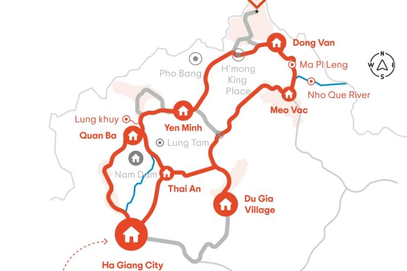
What a Ha Giang Loop map shows you, and what it hides
A map gives you three things: the sequence of towns, the rough shape of the circuit, and a set of distances.
The sequence is useful. The shape is useful. The distances will actively mislead you, and they are the reason so many first time visitors arrive with a plan that does not survive contact with the road.
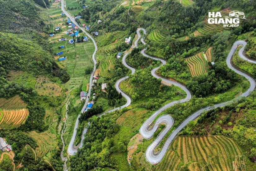
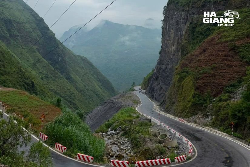
The loop climbs from a river valley onto a limestone plateau and then works its way along the edge of a gorge. Almost nothing about it is flat, and almost nothing about it is straight. Two points that sit close together on the map can be separated by a climb, a pass, and a long descent. Two points that look far apart can be an easy run.
What no map shows:
- Elevation. The single most important variable on this road.
- Weather. Cloud can erase a viewpoint you drove two hours to reach.
- Market days. The best thing on the route is often not a place but a day.
- Where you will actually want to stop, which is almost never where you planned to.
Treat the map as the skeleton. Everything below is the rest of the body.
The shape of the loop
Forget the circle for a moment. The route has a structure, and once you see it, the whole thing clicks.
Ha Giang City is the hinge. It sits low, in a river valley, and it is where the loop opens and closes. Everything on the route is measured outward from here.
The northern arm runs from Ha Giang City up through Quan Ba, then Yen Minh, then onto the Dong Van Karst Plateau proper, and finishes at Dong Van. This is the climbing half. It takes you from a valley floor to the top of a limestone world, and the landscape changes character three or four times on the way.
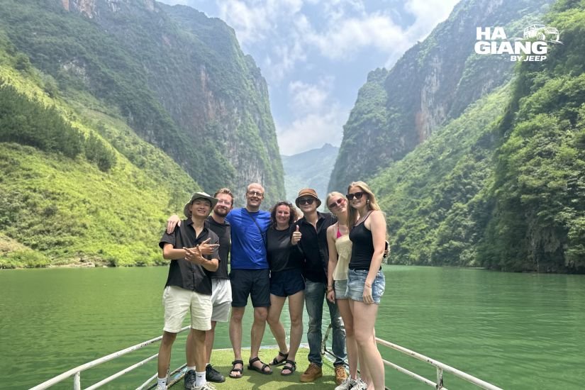
The eastern edge is short and it is the whole point. Dong Van to Meo Vac, over Ma Pi Leng Pass, with the Nho Que river cut into the gorge below you. On a map it is a small segment. In your memory it will be most of the trip.
The southern arm brings you back. From Meo Vac the road turns and works its way southwest toward Du Gia and then back to Ha Giang City. It is greener, softer, less dramatic, and quieter. A lot of people find it is the part they think about afterwards.
That is the loop. A hinge, two arms, and one spectacular edge that connects them. Everything else, including the whole of Cao Bang, is an extension of that basic shape.
Reading the map, stop by stop
Here is what is where, in the order the road gives it to you if you drive the loop in the standard direction.
Quan Ba
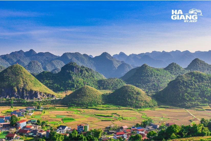
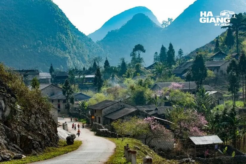
The first real gate. The road climbs out of the valley and Quan Ba is where the plateau announces itself, with a viewpoint over the twin hills and the town below. If you are keeping score, this is the moment the trip actually starts.
Lung Tam
A linen village, slightly off the main line of the route, where indigo dyeing and weaving are still done by hand. Whether the workshop is active varies, so ask before you build a stop around it.
Yen Minh
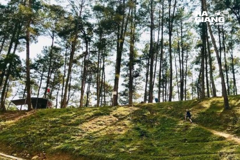
Pine forest, cooler air, switchbacks. A change of climate you feel on your skin. On the map it is a waypoint. On the road it is a distinct chapter.
Sung La and Pho Bang
Sung La is a valley of stone walls and earth walled Hmong houses, a short way off the main road. Pho Bang is quieter still, a faded town that most maps do not bother to mark and most convoys never enter. Both are close together and both are optional, which is exactly why they are worth the detour if your schedule has any room.
Dong Van
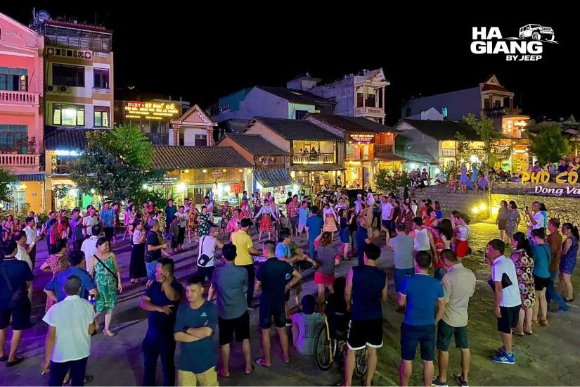
The pivot of the whole route. Stone houses, tiled roofs, an old quarter and a market square, and the place almost everyone sleeps. On a Sunday, the market here draws people from the surrounding valleys.
Lung Cu
The northernmost point of Vietnam, with the flag tower on its hill. On a map it looks like a small spur off Dong Van. In daylight terms it is a genuine detour, and it is the first thing that gets cut from a short trip.
Ma Pi Leng Pass
The road between Dong Van and Meo Vac, carved into the side of the gorge above the Nho Que river. There are pullouts. This is the section where the map is at its most misleading, because the distance is short and the experience is enormous.
Meo Vac
The town at the far end of the pass, and the gateway to the eastern side of the plateau. Its market is one of the most direct windows you will get into life up here. Khau Vai, further out, runs on its own rare calendar, so check before you plan around it.
Du Gia
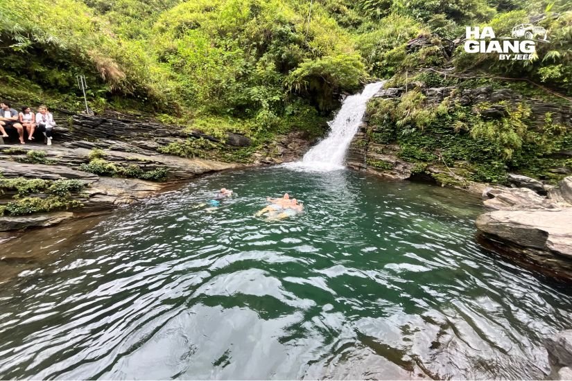
On the southern arm, and the part of the route that shorter itineraries lose first. A village, a waterfall, and an evening pace that the northern half of the loop simply does not offer.

Want the route explained by someone who drives it?
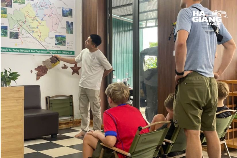
Send us a message and we will walk you through the map for your dates: which stops make sense, which ones to cut, and what the road is doing at that time of year.
Clockwise or counterclockwise?
This question gets asked constantly and it deserves a straight answer: for most travelers it does not matter much, and the standard direction exists for a reason.
The conventional route runs north first, up the climbing arm through Quan Ba and Yen Minh to Dong Van, then east over Ma Pi Leng to Meo Vac, then back down the southern arm. Almost every operator does it this way, and the logic is not arbitrary:
- It puts Ma Pi Leng roughly at the midpoint of the trip, on a morning, which is when the gorge is at its best.
- It builds the landscape gradually, valley to plateau to gorge, rather than delivering the biggest thing on day one and then descending in every sense.
- The overnight stops fall in the places that can actually host you.
Running it the other way is possible, and there are days when a driver will choose to reverse a section, usually because of weather or because a market is happening somewhere and it is worth reorganising the day around it. That kind of decision is the entire value of a local driver, and it is not something you can get from a map.
If you are driving yourself, take the standard direction. If someone else is driving, let them read the day.
The three route variants
The loop is not one fixed line. It is a core route with two optional extensions, and almost every itinerary you will see is one of these three shapes.
| Short route | Classic route | Full route | |
|---|---|---|---|
| Ha Giang City to Quan Ba | Yes | Yes | Yes |
| Yen Minh, Sung La | Yes | Yes | Yes |
| Pho Bang | Rarely | Sometimes | Yes |
| Dong Van | Yes | Yes | Yes |
| Lung Cu | No | Sometimes | Yes |
| Ma Pi Leng and Meo Vac | Yes | Yes | Yes |
| Southern arm, Du Gia | No, returns the way it came | Sometimes | Yes |
| Shape on the map | An out and back with a short eastern hook | A true loop | A true loop with the northern and southern spurs |
The short route is not really a loop, and it is worth understanding that before you book one. It runs up and comes back, with Ma Pi Leng as the far point. That is a perfectly good trip and it is what a compressed schedule buys you. It is just not a circle.
The classic route closes the circle. The full route closes it and takes in both the northern spur to Lung Cu and the southern arm through Du Gia, which is where the loop stops being a road and starts being a region.
How many days each of those needs is a separate question, and we answered it properly in our guide to how many days for the Ha Giang Loop.
Past the edge of the map: the Cao Bang extension
Most Ha Giang Loop maps stop at Meo Vac, and that is a shame, because the road does not.
Keep going east and the geology changes underneath you. The bare grey towers of the Dong Van plateau soften into green conical hills, rivers appear, and you cross out of one UNESCO Global Geopark, Dong Van Karst Plateau, and into a second one, Non Nuoc Cao Bang. Two geoparks, one continuous drive, and a landscape that most visitors to Vietnam never learn exists.
What sits out there:
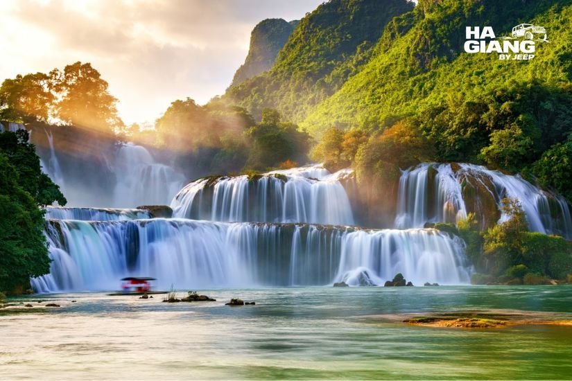
- Ban Gioc Waterfall, wide and tiered and sitting directly on the border. The most impressive single sight in the north, by most accounts.
- The Ngoc Con valley, rivers and rice and limestone, a completely different rhythm from the plateau.
- God's Eye Mountain, a limestone peak with a hole punched clean through it, above a seasonal lake.
- The Pac Bo historical site, for anyone whose interest in the country extends past its scenery.
- The 15 step pass, a road that exists mainly to demonstrate that the engineers here have a sense of humour.
This is not a detour you tack onto a standard loop. It is a different trip, and it needs its own days: the Ha Giang and Cao Bang Jeep Tour 5 Days or, better, the Ha Giang and Cao Bang Jeep Tour 6 Days, which gives the crossing between the two regions a night of its own instead of a long transfer.
What a map cannot tell you about this road
Elevation is the real distance
This is the one that catches everyone. The road climbs and drops constantly, and the effort is vertical, not horizontal. A short segment on the map can be a long stretch of switchbacks. Plan by shape and by sequence, never by the scale bar.
We deliberately do not publish driving times for individual segments, and you should be suspicious of anyone who does. Weather, road works and the occasional landslide all get a vote, and the honest answer to "how long from A to B" is "it depends on the day." Ask us about your specific dates and we will give you a realistic picture rather than a made up number.
Weather redraws the map
Fog and low cloud can sit on the plateau for a morning or a full day, and when they do, a viewpoint stops existing. Ma Pi Leng under cloud is a road with a wall of grey on one side.
This is not a reason to avoid the trip. It is a reason to build a route with some slack in it, and to travel with someone who knows which side of the plateau has cleared today. A good driver will reorder the day around the weather. A printed map cannot.
Market days redraw it too
The markets are the best thing on this route and they are not on any map, because they are a calendar, not a place. Dong Van on a Sunday. Meo Vac. Khau Vai, which runs on a rare schedule of its own. If your dates line up with a market, the market should reshape your route, not the other way round.
Ask before you plan around one. Schedules can shift, and secondhand information about market days is wrong more often than you would think.
Permits and border areas
Parts of the region sit close to the border and have historically required permits. Rules can change and enforcement can change with them, so do not take anything you read online, including this, as final. Book with an operator based in Ha Giang City and let them handle the paperwork. Bring your passport and check the latest updates before you travel.
Eating your way along the route
Here is a map worth having: the food one.
In Ha Giang City and the lower valley, look for banh cuon trung, steamed rice rolls with egg, served here with a bowl of hot broth instead of a dipping sauce. It is the local way and it is better, and it is the correct breakfast before a day of climbing.
On the plateau and at the roadside, com lam, sticky rice cooked inside bamboo over a fire, sold wherever there is a fire and someone with time.
In Dong Van after dark, when the temperature drops and it will, thang den: warm glutinous rice balls in ginger syrup. And chao au tau, a thick, faintly bitter porridge made from a local tuber, eaten in the evening and considered warming.
Everywhere, ruou ngo, corn wine, which somebody will eventually pour for you.
The practical point, and the reason this belongs in an article about maps: with a private jeep and a driver, the food stops are not a logistics problem. You pull over at the stall that smells right. You sit down at a market because a woman is ladling something out of a pot and you want to know what it is. You accept the corn wine at the homestay, because you are not the one driving in the morning, and nobody is worrying about where a vehicle is parked.
The best stops on this route are the ones that were never on the map. Being able to take them is the whole argument.
Mistakes people make when planning from a map
- Planning by the scale bar. The road climbs. The map does not.
- Assuming the short route is a loop. It usually is not. It is an out and back with a hook at the end. Perfectly good, but know what you are buying.
- Building the trip around Lung Cu. It is a real detour and it is the first thing a tight schedule should cut.
- Ignoring the southern arm. Du Gia and the road home are not filler. On the map they look like the boring bit. On the ground they are frequently the favourite bit.
- Trusting driving times you found online. Nobody can give you those honestly, including us.
- Planning around a market you did not verify. Markets have their own calendar. Ask.
- Leaving the Hanoi journey out of the plan. Ha Giang City is where the map starts, but it is not where you start. Getting up there is its own journey and it does not appear on any loop map at all.
Which jeep tour is right for you?
3 days if you want the classic route, closed properly, at a sensible pace. The Ha Giang Loop Jeep Tour 3 Days is what most guests book and it is the shape the road wants.
4 days if you want the full route: the northern spur, the southern arm, Du Gia, and the villages that shorter itineraries drive past. The Ha Giang Loop Jeep Tour 4 Days is the one people wish they had booked once they see the map from the road rather than the page.
5 or 6 days if you want to drive off the edge of the Ha Giang Loop map entirely and into Cao Bang. The Ha Giang and Cao Bang Jeep Tour 5 Days and the Ha Giang and Cao Bang Jeep Tour 6 Days take in Ban Gioc Waterfall, God's Eye Mountain, the Ngoc Con valley and the Pac Bo historical site. Two UNESCO Global Geoparks, one road.
The rental if you are a confident driver and you would rather read the map yourself. The Jeep Wrangler Rubicon rental goes by the day, with route advice from people who drive these passes for a living. Requirements for driving in Vietnam can change, so check the latest updates and talk to us first.
If you want to know what a day on this route actually feels like from inside the vehicle, we wrote that up in our guide to what to expect on a Ha Giang jeep tour.
Ready to drive the route rather than read it?
Every jeep is private. You are never grouped with strangers. Your driver was born in these mountains, speaks English, and knows which side of the plateau has cleared this morning and which one is still under cloud.
We are based in Ha Giang City, we are on WhatsApp 24 hours a day, and we handle the border area paperwork so you do not have to think about it. Tell us your dates and we will send you the route that actually fits them.
booking@hagiangbyjeep.com · +84 862 379 288 · +84 938 988 593
FAQ
It is a rough circle north of Ha Giang City, with a climbing arm up through Quan Ba and Yen Minh to Dong Van, a short and spectacular eastern edge over Ma Pi Leng Pass to Meo Vac, and a southern arm running back through Du Gia. Ha Giang City is the hinge where the loop opens and closes.
The distance is less useful than it sounds. The road climbs, switches back and drops constantly, so time on the road is governed by elevation and conditions rather than kilometres. Anyone quoting you precise driving times is guessing.
The standard direction runs north first, then east over Ma Pi Leng, then back down the southern arm. It puts the pass around the midpoint and builds the landscape gradually. Reversing a section is sometimes worth it for weather or a market, which is a call best made on the day.
Yes. Every itinerary includes it, from the shortest to the longest. What changes is how much time you get to stand there, which is largely a function of how many days you have.
The short route is really an out and back with an eastern hook, not a closed circle. The classic route closes the loop. The full route adds the northern spur to Lung Cu and the southern arm through Du Gia. Read our guide to how many days you need before choosing.
Not to a standard loop. Ban Gioc sits in Cao Bang, east of Meo Vac and past the edge of most maps, and it needs the five or six days combo itinerary. The six days version does it without a punishing transfer day.
Some areas near the border have required permits historically. Rules can change, so do not rely on secondhand information. Book with an operator based in Ha Giang City and let them handle the paperwork, and bring your passport.
Du Gia and the southern arm, most often. On a map they look like the least interesting section. On the road they are quiet, green, and frequently the part people talk about afterwards.
Markets are a calendar, not a place, and they are often the best thing on the trip. Dong Van on a Sunday, Meo Vac, and Khau Vai on its own rare schedule. If your dates line up with one, reshape the route around it rather than the reverse. Verify the day before you plan around it.
Yes, if you are a confident driver. The Wrangler Rubicon rental goes by the day and we will talk you through the route before you leave. Rules and requirements for driving in Vietnam can change, so check the latest updates and speak to us first.