
Ha Giang Jeep Tour: What to Expect on the Loop
The Ha Giang Loop is not like other trips. The cold arrives before dawn, the wind at Ma Pi Leng does not appear in any forecast, and the best things on the road are the ones nobody told you about in advance.
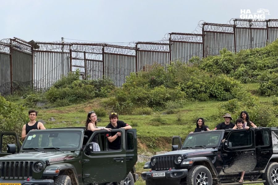
Most travel content about Ha Giang focuses on the photographs: the buckwheat flowers, the karst ridges above the Nho Que River, the view from Ma Pi Leng Pass. What it rarely explains is what the day actually feels like from inside the vehicle, or what happens between the viewpoints.
This is that guide. What a day on the Ha Giang jeep tour looks like from 6 in the morning to the moment you sit down for dinner at the homestay, including the cold, the wind, the altitude sun, the food, the places you stop and the ones you pass through slowly enough to look.
How a Day on the Loop Begins
The departure is early. On the Ha Giang jeep tour, most days start at 7 in the morning, which means that the first climb of the day, up from Ha Giang City onto the plateau, happens while the light is still coming sideways through the limestone and the temperature on the road has not yet recovered from the night.
This is not a complaint. The early start is part of what makes the loop what it is.
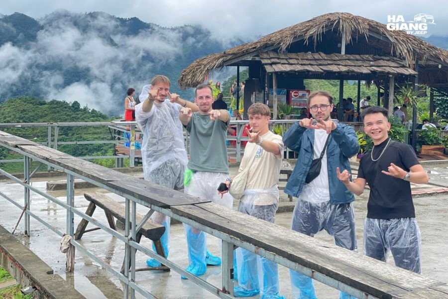
The road out of Ha Giang City passes through the Quan Ba district and begins to climb almost immediately. Quan Ba is where most travelers get their first understanding of what the plateau means: the valley floor drops away, the road switchbacks up through forest and into an openness that does not exist at lower elevations. The Twin Mountains, a pair of rounded limestone hills that rise symmetrically from the valley floor below Quan Ba Heaven Gate, are the first landmark most people photograph.
By mid-morning on a clear day, the plateau above Yen Minh has warmed enough that the soft top goes back. This is the moment the trip changes. The difference between looking at the landscape through a windscreen and looking at it through nothing is not subtle. The wind in your face on a descent above the corn fields below Yen Minh pine forest is a sensory experience that no photograph has ever communicated.
Mid-morning: the places where you stop
The driver knows where the road is good to pause and where it is not. These stops are not always the obvious viewpoints. Sometimes they are a curve in the road above Sung La Valley where the light is doing something specific to the terraced fields below. Sometimes it is a village like Pho Bang, which most tours drive through without stopping and which has an old French Indochina quarter of colonial-era buildings that have been standing since before either side of that history was resolved.
The mid-morning stop at Lung Tam Linen Village is a different kind of experience: the women of the White H’mong community at Lung Tam have been weaving linen on hand looms in the same way for generations. The fabric is dyed with indigo. The patterns are not decorative in the tourist sense; they are specific to the community and carry meaning. Fifteen minutes in Lung Tam tells you something about Ha Giang that a day of viewpoints does not.
The lunch stop
Lunch happens somewhere along the road. On a private jeep tour, where you eat is a decision made by the driver based on what is good at the moment and what the group wants. The roadside stalls in the small towns between Yen Minh and Dong Van have com lam (sticky rice cooked in bamboo), banh cuon trung (steamed rice rolls with egg), and whatever the family that runs the place made that morning.
The lunch stop on a good day is not rushed. Nobody is loading a van for a shared departure. The driver knows which stall has the best chao au tau (opium flower porridge, which sounds alarming and is not), and you have time to sit on a plastic stool and watch the road while you eat.
Afternoon: the light, the passes, and the long views
The afternoon on the Dong Van Karst Plateau is when the trip earns its reputation.
The road from Dong Van to Meo Vac via Ma Pi Leng Pass is the section most photographers talk about and most travelers remember longest. The Nho Que River runs at the bottom of a gorge 800 metres below the road. The canyon is called Tu San and is the deepest canyon in Southeast Asia. The road does not have a guardrail for much of its length. The wind arrives from the valley without warning and is cold even in October.
At the M Viewpoint above the pass, which requires a short walk from the vehicle, the full sweep of the canyon is visible: the river turquoise at the bottom, the karst walls on both sides, the road you have just driven curving above it. This is the photograph that everyone takes and the moment that everyone talks about at dinner.
Meo Vac arrives in the early afternoon. The town at the bottom of the pass has a market twice a week, and if the timing works, the Khau Vai Love Market (held in April) is one of the most specific cultural events in the northern highlands.
Evenings at the homestay
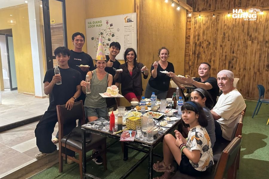
The day ends at a homestay in Meo Vac, Dong Van, or wherever the itinerary puts you. Highland homestays are not hotels: the beds are firm, the blankets are thick (and necessary), and dinner is cooked by the family and served at a shared table.
The conversation at the table, if the group wants it, is often the most interesting part of the day. The driver, who has been explaining things since morning, tends to be most forthcoming about the area and the people when the road is behind him and the corn wine is on the table.
Ruou ngo, the corn wine that appears at nearly every highland meal, is made by the local H’mong communities. It is strong, clear, and poured freely. Drinking it is optional. Declining it gracefully is a skill the driver can help with.
The Weather You Will Actually Meet
Three things about the weather on the Dong Van Karst Plateau are genuinely surprising to travelers who did not plan for them.
The cold at the passes
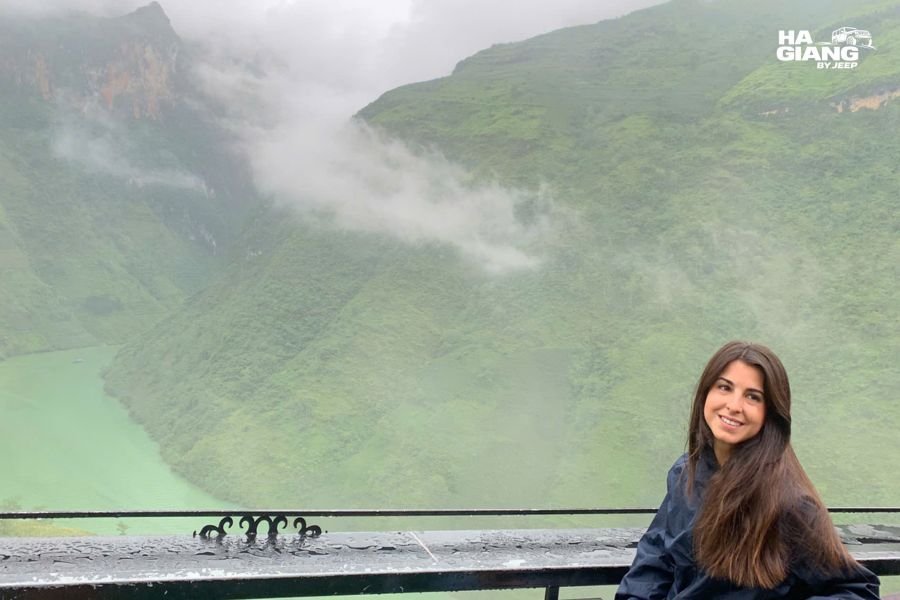
The plateau sits at elevations between 1,000 and 1,600 metres. The temperature at dawn from October through March is consistently colder than the forecast for Ha Giang City suggests. The city is in a valley; the forecast is for the valley. The passes are higher, more exposed, and significantly colder in the early morning.
In December and January, frost is possible on the grass at the highest elevations. Breath fogs. The fingertips of people who did not bring gloves are cold by the time the jeep stops for the first viewpoint.
The good news is that the temperature rises quickly once the sun clears the ridgeline, and by mid-morning on a clear day the plateau is often warm enough to remove a layer. The cold is a morning problem. Pack for it and it stops being a problem.
The wind on Ma Pi Leng Pass
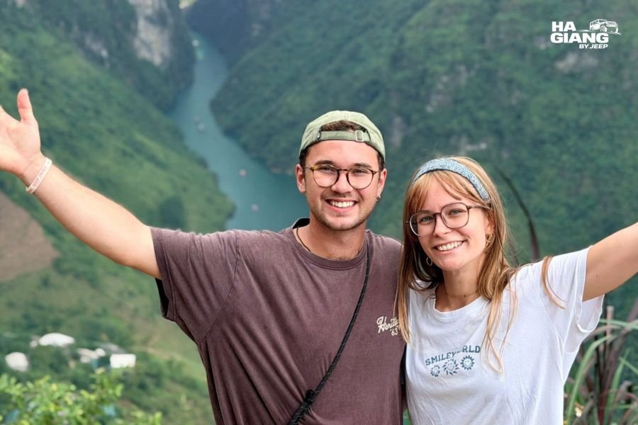
The wind on the exposed viewpoints of the Ha Giang Loop is the most underestimated weather element. It does not appear in forecasts, and photographs do not convey it.
At the M Viewpoint above Ma Pi Leng, or at any of the exposed clifftop stops on the pass, the wind arrives from the canyon below without obstacle. It makes the effective temperature significantly lower than the air temperature. A light windproof layer is more useful here than a heavy jacket, which is too warm for midday but inadequate at the pass when the wind is running.
The sun at altitude
The sun at 1,500 metres burns faster than most travelers expect, particularly in October and November when the air is clear and the sky is that specific post-monsoon blue that makes everything look mild. Sunscreen is not optional on the loop regardless of season.
Sunglasses matter too: the limestone of the Dong Van Plateau reflects light in a way that produces glare on clear days, and eye fatigue on a sunny highland afternoon is real.
The soft top on the Jeep Wrangler Rubicon is the practical response to all three: open when the day is good, closed when cold or rain arrives, heating on in the morning. The driver decides based on the road and the sky ahead.
The Places: What the Loop Looks Like from the Road
The Ha Giang Loop covers different characters of landscape across four days. Understanding which stretch of road you are on helps make sense of what you are seeing.
Ha Giang City and the departure
Ha Giang City is where the loop starts. It is a river town, not a highland town, and the climate and the feel are different from the plateau. The city has a few things worth a morning if you arrive the day before: the Ha Giang Museum for context on the highland communities, and the riverside in the evening for dinner before the early start.
Quan Ba and the first climb
The road from Ha Giang City climbs quickly into Quan Ba District. Quan Ba Heaven Gate is the first major viewpoint: the plateau ahead, the valley behind, the Twin Mountains below. The Dao villages in the Quan Ba valley, including Nam Dam, are accessible from the main road and give the first encounter with highland textile traditions.
Yen Minh and the pine forest
The road through Yen Minh passes through a section of pine forest that looks unlike the rest of the loop: straight trunks, needle floor, a European quality to the light. This section is often missed in photographs of Ha Giang because it is not dramatic, but it is beautiful in a quiet way.
Dong Van: the Old Quarter and the Sunday Market
Dong Van Old Quarter has a cluster of French Indochina-era buildings in the center of town that have survived well enough to understand what the architecture was trying to do: thick walls for the altitude climate, covered walkways, a market structure that still functions on Sundays.
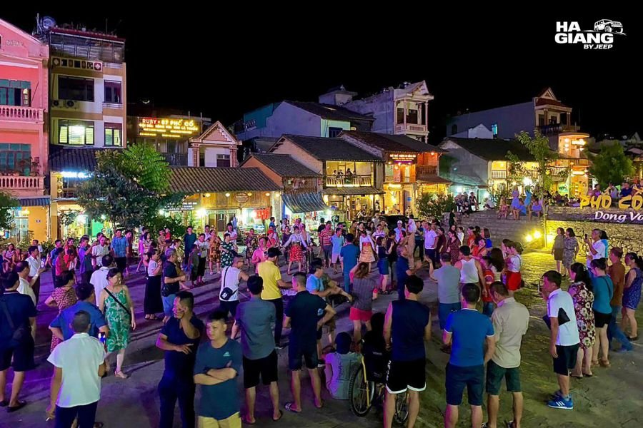
The Dong Van Sunday Market is one of the largest highland markets on the loop. H’mong, Dao, Lo Lo, and Tay communities come down from the surrounding villages. The market is not a tourist market: it exists for the communities that use it, which means the goods on sale are the goods people in these villages actually need. The textiles, the livestock section, and the food stalls are each a separate world.
Pho Bang, a few kilometres from Dong Van, is an old town with a colonial-era quarter that most tours pass through without stopping. The local team at Ha Giang by Jeep knows to pause here for people who are interested in the architecture and the quieter side of the plateau.
Lung Cu, the northernmost point of Vietnam, is a detour from Dong Van worth taking on the 4-day version of the loop. The flag tower at Lung Cu marks the border with China. The view north and south from the base of the tower is one of the clearest expressions of how the plateau sits in the landscape.
Ma Pi Leng Pass and the canyon road
The 20 kilometres between Dong Van and Meo Vac along Ma Pi Leng Pass is the stretch that defines the loop’s reputation. The road was cut by hand into the cliff face over four years by a team of young volunteers in the late 1950s. It is called the Happiness Road.
The 15-step pass section, visible from the M Viewpoint, is the hand-cut section of the road that drops down the canyon wall in a series of tight turns that look, from above, like they were drawn onto the cliff rather than carved from it.
The Tu San Canyon below is 800 metres deep in places. The Nho Que River at the bottom appears turquoise from altitude. The M Viewpoint above the pass is the stop that takes the longest because people keep looking for different angles.
Sung La Valley and the way back
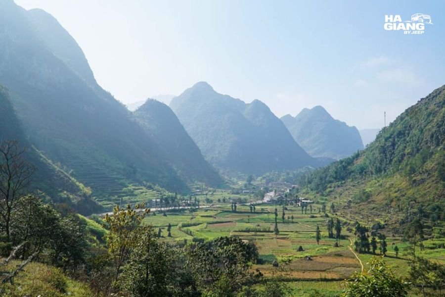
The route back from Meo Vac passes through Sung La Valley, which is the valley that appears most often in Ha Giang travel photography without the photographer always knowing which valley it was. The terraced fields, the limestone ridges on each side, and the single road through the middle of it produce the photographs that look like they were composed.
Du Gia is the last major stop before the return to Ha Giang City. The waterfall at Du Gia and the swimming pool below it are the reason the 4-day itinerary ends this way: after three days of highland cold and wind, the swim is not incidental.
On the extended tour: Cao Bang
The 5-day and 6-day tours continue from Ha Giang to Cao Bang Province and the Non Nuoc Cao Bang UNESCO Geopark, adding Ban Gioc Waterfall (the largest waterfall in Vietnam), Nguom Ngao Cave, God’s Eye Mountain on Thung Khanh Pass, Ngoc Con Valley above the source of the Quay Son River, and Pac Bo Historical Site where Ho Chi Minh returned to Vietnam in 1941.
The loop does not stop at Ha Giang. If you are wondering whether the Cao Bang extension is worth the extra days, read the Ha Giang and Cao Bang 6-day tour page and the 5-day version. The short answer: yes, if you have the time.
The Food Along the Way
The food on the Ha Giang Loop is not an afterthought. It is a consistent part of the day, and the private jeep format makes it possible to eat where the driver knows to eat rather than where the tour schedule says to stop.
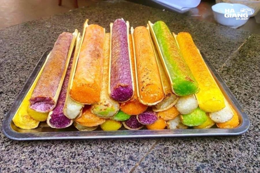
Com lam: Sticky rice packed into a section of bamboo and cooked over an open fire. The bamboo imparts a specific flavor and keeps the rice warm. Sold at stalls along most of the loop road, served with sesame salt or a small piece of grilled pork. The most practical food on the road: filling, packable, and eaten without cutlery.
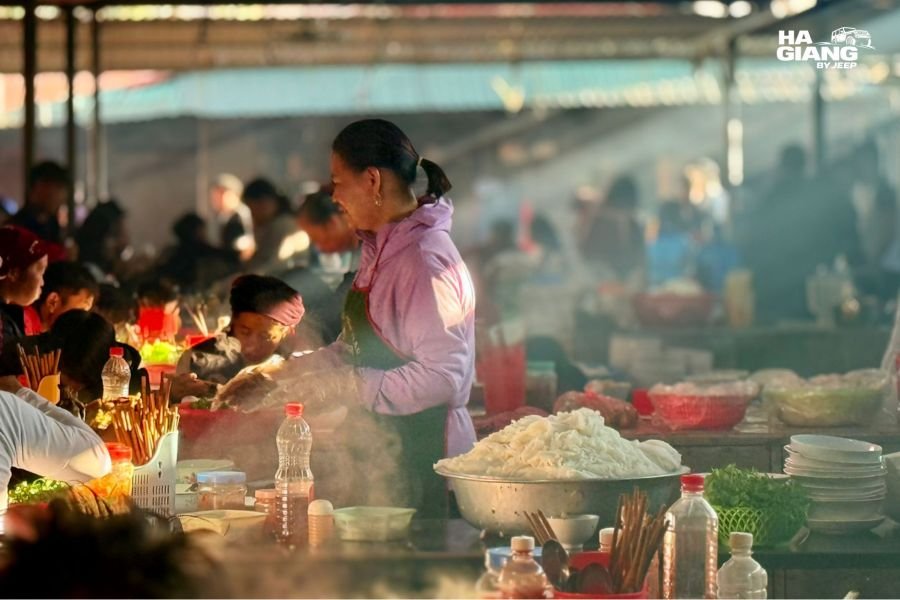
Thang den: A warm sweet rice ball soup that appears at highland markets and roadside stalls from October onward. The soup is sweet, the balls are filled with ground sesame and peanut, and on a cold morning at a market at 1,400 metres, it is the most useful food in the world. Dong Van Sunday Market always has it.
Banh cuon trung: Steamed rice rolls with egg, served at breakfast stalls in most small towns on the loop. Light, slightly chewy, eaten with a dipping sauce. The Ha Giang version tends to be simpler than the Hanoi version and better for it.
Chao au tau: Congee made from the seeds of the opium flower plant (the plant, not the product). The flavor is slightly bitter, the texture is thick, and the name reliably stops people before the first spoonful. It is a northern highland staple, more common in Ha Giang and Cao Bang than anywhere else in Vietnam.
Ruou ngo: Corn wine. Made by the H’mong communities from fermented corn, distilled clear, usually drunk warm in small ceramic cups. It is strong. It appears at most evening meals at homestays. The driver, who has driven this road in both directions after corn wine and without it, will give you an honest assessment of how much is appropriate.
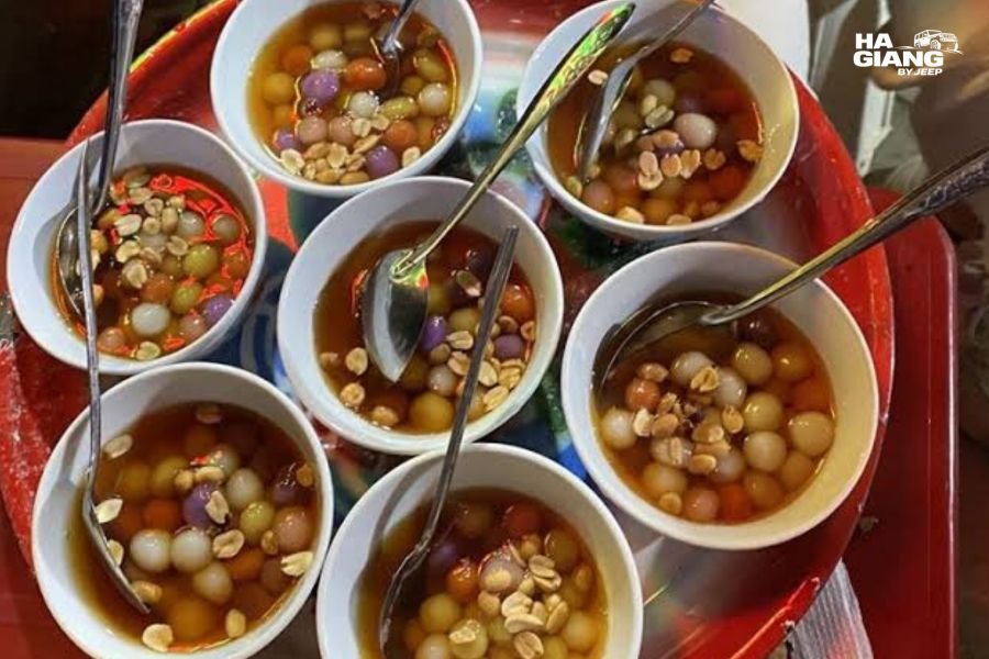
The food stops on a private jeep tour are decided by the driver, which means they are decided by someone who eats this food every day. The stall next to the famous viewpoint is not always the stall worth stopping at.
What a Private Jeep Makes Possible
The specific advantages of the Ha Giang jeep tour format become clear in practice rather than in theory.
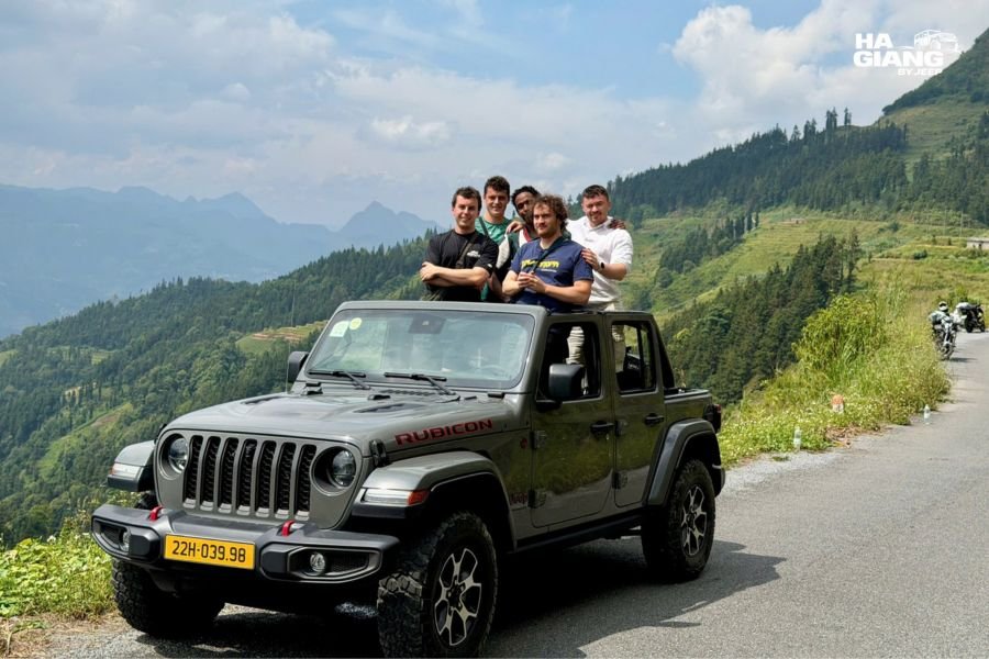
Private means the schedule is yours. No other passengers. No shared departure time. If the light on Sung La Valley is doing something particular at 4 in the afternoon and you want to stay for it, you stay. If the market in Dong Van is more interesting than expected and you want another hour, you take it. The driver adapts because the driver works only for you.
The open roof is not a feature. It is the experience. The Jeep Wrangler Rubicon has a soft top that opens completely. The view from the back of an open-air 4x4 on Ma Pi Leng Pass, with the canyon below and the wind in your face, is not the same experience as looking through a window. Many travelers who have done both describe the window version as feeling like watching a film and the open version as being in it.
The soft top and heating are the response to the cold. When the morning is cold or the pass is wet, the top closes and the heating comes on. The transition takes a few minutes. The result is that the cold and rain on the Ha Giang plateau are conditions you observe rather than conditions you endure.
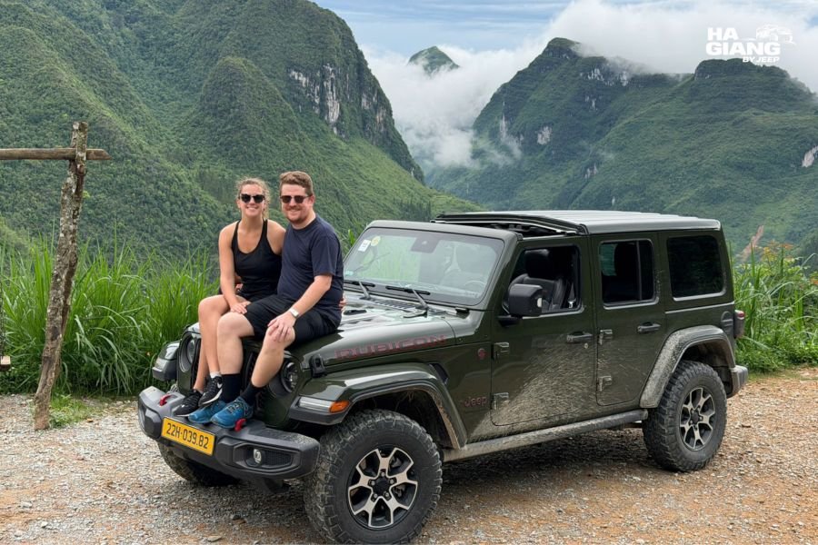
The driver is from here. Not from Hanoi, not from a tourism company that sends staff to the loop seasonally, but from the highlands of Ha Giang and Cao Bang. The driver knows the family that runs the stall with the best chao au tau in Yen Minh. They know which guesthouse in Dong Van has the warmest blankets. They know when the Sunday market in Dong Van is about to get busy and when to leave before the road back fills up.
Over four days, that knowledge produces a different kind of trip.
Planning a private jeep tour? The Ha Giang Loop 4-day tour is the version most returning travelers recommend. The 3-day tour is the right choice when time is genuinely short.
Which Jeep Tour Is Right for You?
Ha Giang Loop 3 days covers the main passes, Dong Van Old Quarter, Ma Pi Leng, and Meo Vac at a compressed but achievable pace. Right for travelers with limited time who want the core experience without the additional days.
Ha Giang Loop 4 days adds Du Gia, slower mornings, and time at the Sunday markets. This is the version most people who have done both would recommend: the extra day removes the sense of rushing through each stop toward the next one.
Ha Giang and Cao Bang 5 days or 6 days extends the loop through Cao Bang Province, adding Ban Gioc Waterfall, Nguom Ngao Cave, God’s Eye Mountain, Ngoc Con Valley, and Pac Bo. The 6-day version includes Thang Hen Lake on the Cao Bang plateau.
Jeep Wrangler Rubicon rental for travelers who want to drive the loop themselves in a 4x4 without a driver.
Questions about which itinerary fits your group and dates? Message on WhatsApp and someone from the team will give you a straight answer.
Frequently Asked Questions
The day starts early, usually at 7 in the morning, with the first climb out of Ha Giang City onto the plateau. Morning is cold, particularly at the passes. By mid-morning the temperature has usually risen, and the soft top goes back for the open-air section of the day. Afternoons on the passes are the photographic heart of the trip. Evenings are at homestays with a family dinner.
The Dong Van Karst Plateau sits between 1,000 and 1,600 metres. From October through March, morning temperatures at the passes can be genuinely cold: breath fogs, frost is possible in December and January at the highest points. The jeep has heating in the closed-top configuration. A thermal layer for mornings and a windproof shell for the passes cover most of the year. The full packing and weather guide has more detail on what to bring for each season.
At the open viewpoints above the canyon, yes. The wind arrives from the valley below without obstacle and makes the effective temperature significantly lower than the air temperature. A windproof outer layer is more useful than a heavy jacket at the pass viewpoints. The wind is also part of what makes the stop memorable.
Com lam (bamboo rice), thang den (warm sweet rice ball soup), banh cuon trung (steamed rice rolls with egg), and chao au tau (opium flower congee) are the dishes most specific to the highland road. Corn wine (ruou ngo) appears at most homestay dinners. The driver knows which stalls are worth stopping at.
On a private tour, yes. The vehicle and the day are yours. If you want to stay longer at a market, stop for a roadside stall not on the itinerary, or skip a viewpoint you have already seen, the driver adapts. This is the main practical difference between a private jeep tour and a shared or group tour.
The Dong Van Sunday Market is one of the largest highland markets on the loop. H’mong, Dao, Lo Lo, and Tay communities from the surrounding villages come to trade. It is not a market that exists for tourists: the goods are the goods these communities use, including textiles, livestock, hardware, and food. The food section, with thang den, com lam, and grilled meat, is the most accessible entry point.
Yes. The loop is driven rather than trekked. The stops are short walks from the vehicle on paved or compacted surfaces. The jeep has heating for cold mornings and the soft top closes in rain. Families with young children and travelers in their 60s and 70s do the loop regularly. The 4-day version is better for this group than the 3-day because the pace is less compressed.
October and November are the most popular months: the buckwheat flowers are on the plateau, the post-monsoon sky is clear, and the light on the karst landscape is at its most photogenic. March to May is the green season with fewer crowds. December and January are cold but quiet and have a specific beauty. July and August bring rain and reduced visibility but also full waterfalls and deep green terraces.
The 5-day and 6-day tours add Cao Bang Province after the Ha Giang Loop. The main additions are Ban Gioc Waterfall (the largest in Vietnam), Nguom Ngao Cave, God’s Eye Mountain, Ngoc Con Valley, and Pac Bo Historical Site. The landscape in Cao Bang is different from Ha Giang: more horizontal, more forested, and in some ways more surprising for travelers who assume the second geopark will be more of the same.
One day. The 4-day version adds Du Gia (waterfall, village, the swimming stop), allows for a less compressed morning at Dong Van Sunday Market, and removes the feeling of needing to leave each place before you have finished with it. Travelers who have done both versions consistently recommend the 4-day for any group that values having time at the stops rather than ticking the stops off.
Yes. ATMs are available in Ha Giang City, Dong Van, and Meo Vac, but coverage on the road between those towns is limited. Roadside stalls, market food, and village stops are cash-only. The driver can advise on how much to withdraw before departure based on the planned itinerary.
Yes. The Ha Giang jeep tour is structured for travelers who are new to northern Vietnam. The driver explains the landscape, the communities, and the history as you go. The logistics of the loop, including accommodation, most meals, and the permits for the border areas, are handled as part of the tour.
Ha Giang by Jeep runs private 4x4 tours across the Dong Van Karst Plateau and Non Nuoc Cao Bang Geoparks. Email booking@hagiangbyjeep.com or WhatsApp +84 862 379 288.