
Cao Bang Loop 3-Day Itinerary: Day by Day Guide
Three days inside a UNESCO Global Geopark that most Vietnam travelers never find. You will come back changed.
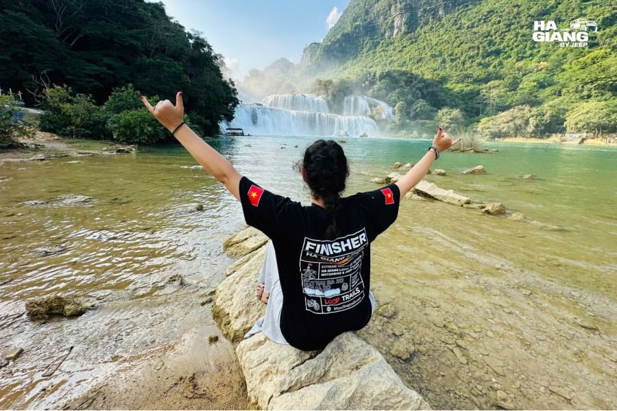
The Cao Bang Loop is a circuit through the Non Nuoc Cao Bang UNESCO Global Geopark that starts and ends in Cao Bang City. It covers three days of the region's most distinct landscapes and stops: Vietnam's largest waterfall, a cave system under three mountains, a limestone formation with a hole you can see straight through, a historical site where Ho Chi Minh returned to Vietnam after three decades away, and two living craft villages that have been producing incense and handmade paper for generations.
It is not an extension of the Ha Giang Loop in the sense that you do it instead. It is a route that can follow the Ha Giang Loop naturally, entering Cao Bang from the west, or that can be done as a standalone trip from Cao Bang City. This guide covers the standalone version: Day 0 travel to Cao Bang City, three days on the loop, and departure south on Day 3.
Table of Contents
1. What the Cao Bang Loop covers 2. Day 0: Getting to Cao Bang City 3. Day 1: Craft villages, fossil hills and the route west 4. Day 2: Ban Gioc Waterfall, the boat and Nguom Ngao Cave 5. Day 3: God's Eye Mountain, Ngoc Con and the return 6. Summary table: 3 day Cao Bang Loop 7. What the 3 days version misses 8. Practical notes 9. Which jeep tour is right for you 10. Frequently asked questions
What the Cao Bang Loop Covers
The six main reasons to do the Cao Bang Loop:
Ban Gioc Waterfall. Vietnam's largest waterfall and the most visited site in the province. It falls on both the Vietnamese and Chinese sides of the Quay Son River. The boat trip from the Vietnamese bank takes you close to the base of the lower tier.
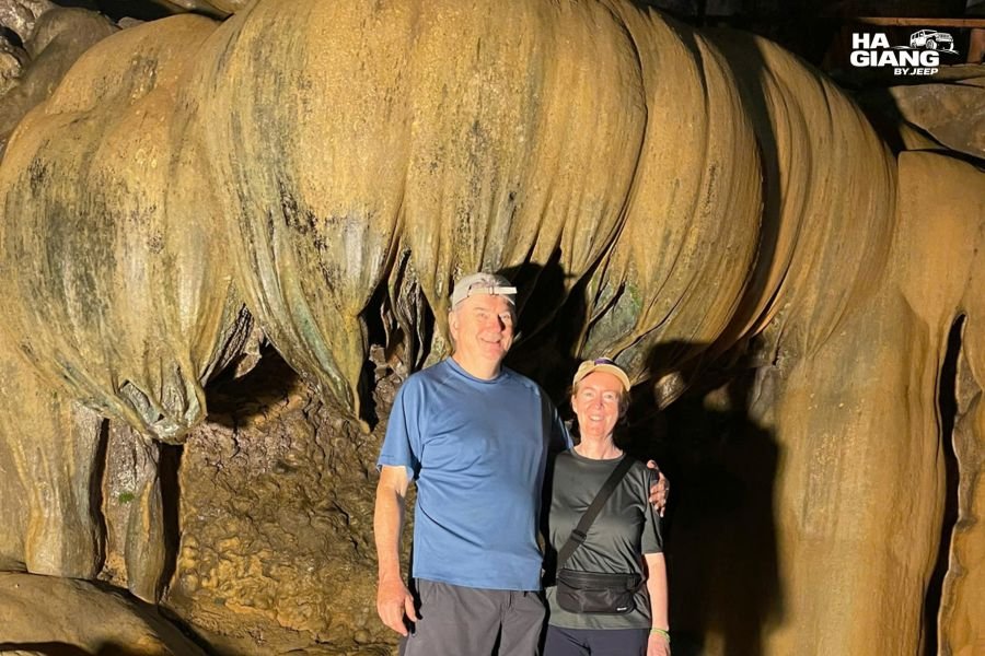
Nguom Ngao Cave. A cave system that runs under three mountains, with stalactite and stalagmite formations of unusual scale. Around an hour to walk through properly.
Pac Bo Historical Site. Lenin Stream, Karl Marx Mountain and Coc Bo Cave, where Ho Chi Minh lived and worked after returning to Vietnam in 1941.
God's Eye Mountain. The landmark most associated with the Non Nuoc Cao Bang Geopark: a limestone mountain with a natural hole straight through its peak. From below, the hole frames the sky.
Living Nung craft villages. Phia Thap, where incense sticks have been hand-rolled for generations, and Dia Tren, where paper is still made from tree bark using methods that pre-date modern papermaking.
Ba Quang Hills and Tra Linh Fossils. Rolling grass hills that look unlike anything else on the northeast route, and marine fossils embedded in limestone at Tra Linh that are approximately 260 million years old.
See the Ha Giang and Cao Bang 5 day tour
Day 0: Getting to Cao Bang City
The tour starts at 07:30 on Day 1 in Cao Bang City. That means Day 0 is a travel day, not a tour day. Most travelers come from Hanoi, which is a five to six hour journey by road.
Options from Hanoi include the day bus, which arrives in Cao Bang City in the afternoon, or the overnight sleeper bus, which arrives early morning. Confirm current schedules and departure points close to your travel dates.
For the standalone Cao Bang Loop, arriving the day before the tour starts and spending the pre-tour night in Cao Bang City is the standard arrangement. This gives you a relaxed start to Day 1 at 07:30 rather than a rushed connection.
Day 1: Craft Villages, Fossil Hills and the Route West
Day 1 routes west from Cao Bang City through the province's craft and fossil landscapes, arriving near the Pac Bo area for the first overnight.
Phia Thap Incense Village
Phia Thap is a Nung village where incense sticks have been produced by hand for generations. The process is visible throughout the village: bamboo strips are dipped, rolled, dried in the sun in large fans of colour. The incense is made from the bark of the bau tree mixed with wood powder, and the colour of each stick indicates its intended use.
It is one of those places that takes about twenty minutes to walk through and stays with you longer than that.
Dia Tren Paper Village
A short distance from Phia Thap, Dia Tren produces handmade paper using tree bark. The process is slow and the paper is thick, used for religious ceremonies and traditional purposes. Watching it being made in the workshop behind the village houses is the kind of craft demonstration that is not staged for visitors.
Tra Linh and the Marine Fossils
At Tra Linh, limestone outcrops contain marine fossils estimated at 260 million years old. The fossils are embedded in the rock in visible concentrations and represent a period when this part of Asia was underwater. Seeing them is free and takes about fifteen minutes. The geological context, that you are standing on what was once a seabed, is what makes it more than a geology lesson.
Ba Quang Grass Hills
The Ba Quang area has rolling grass hills that stand out sharply against the limestone and rice valley landscapes of the rest of the province. The hills have a quality that most visitors describe as looking like a painting rather than a landscape.

Overnight: Truong Ha Homestay
Day 1 ends at a homestay in the Truong Ha area, which sits near the Pac Bo historical site. The homestay provides home-cooked Tay and Nung food, and the evening dinner with local rice wine is where the day gets processed.
Day 2: Pac Bo, Ban Gioc Waterfall and Nguom Ngao Cave
Day 2 is the Ban Gioc day. Getting to the falls early matters, and Day 2 starts from the homestay near Pac Bo, which positions you well for a morning arrival.
Pac Bo Historical Site
The first stop of Day 2 is Pac Bo, a forested valley right on the Chinese border where Ho Chi Minh lived between 1941 and 1945 after returning to Vietnam. Coc Bo Cave, where he wrote and worked, is accessible. Lenin Stream, which he named, runs alongside the path. Karl Marx Mountain is visible across the valley.
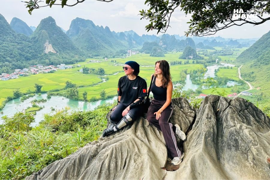
For travelers with an interest in twentieth-century Vietnam, Pac Bo carries real weight. The physical site is modest and forested, and the quietness of it is part of what makes it work.
Phat Tich Truc Lam Pagoda
A Buddhist pagoda set against a limestone cliff on the way toward the Ban Gioc area. Worth a stop of twenty to thirty minutes for the setting as much as the pagoda itself.
Ban Gioc Waterfall
The main event of the loop. Ban Gioc falls on both sides of the Quay Son River, which forms the border with China. The Vietnamese side has the main viewing area, the entrance facilities and the boat landing.
Three tiers, the widest waterfall in Vietnam, the mist from the base reaching the viewing area when water levels are high. The boat trip by sampan takes you from the bank toward the falls and back, approaching the lower tier from the front. The view from water level looking up at the curtain of water is not the same as the view from the bank.
Water levels at Ban Gioc change dramatically by season. Our Ban Gioc water levels guide covers what each month delivers.
Nguom Ngao Cave
A short drive from Ban Gioc, Nguom Ngao Cave runs under three mountains. Walking through it takes about an hour at a steady pace. The chambers are large, the formations are well lit and the scale of the interior is one of those things that surprises people regardless of what they expected.
Overnight: Homestay Near Ban Gioc
Day 2 ends near the Ban Gioc area. The second night is in a homestay with dinner included. The proximity to the falls means an early start on Day 3 is easy if you want to catch the falls in the morning light before leaving.
Day 3: God's Eye Mountain, Ngoc Con and the Return
Day 3 routes back toward Cao Bang City through the geopark's most visually striking landscapes.
Ngoc Con Viewpoint
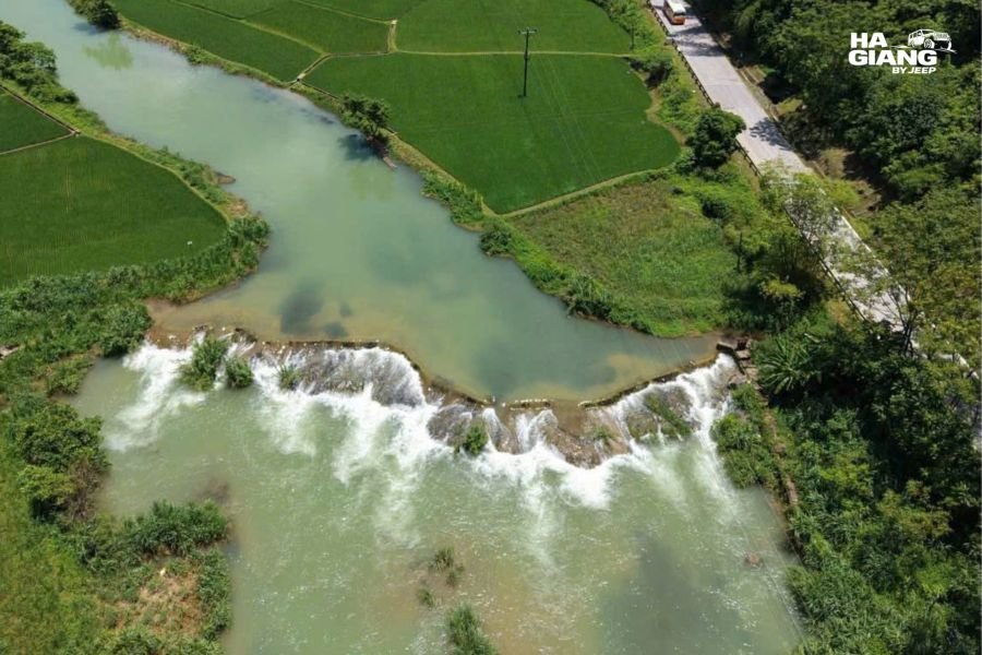
The source of the Quay Son River emerges from the limestone at Ngoc Con. The viewpoint above the valley gives a clear view of where the river begins and the landscape it flows through. It is a different angle on the same water system that ends at Ban Gioc.
God's Eye Mountain
Nhin Mat Than, God's Eye Mountain, is the most photographed feature of the Non Nuoc Cao Bang Geopark. The limestone formation has a natural hole through its peak that, from the approach road below, frames the sky in the shape of an eye.
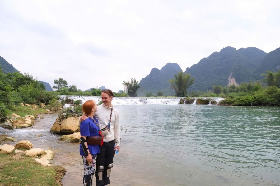
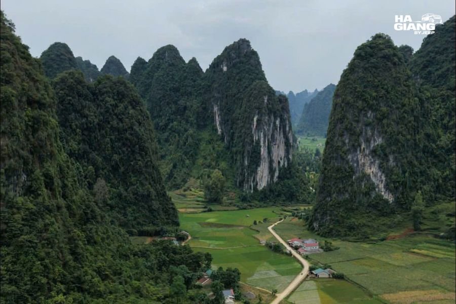
The valley below God's Eye Mountain is Ngoc Con Valley, which extends away from the road in a green basin with limestone towers on all sides. It has the quality of a landscape that opens suddenly and takes a moment to process.
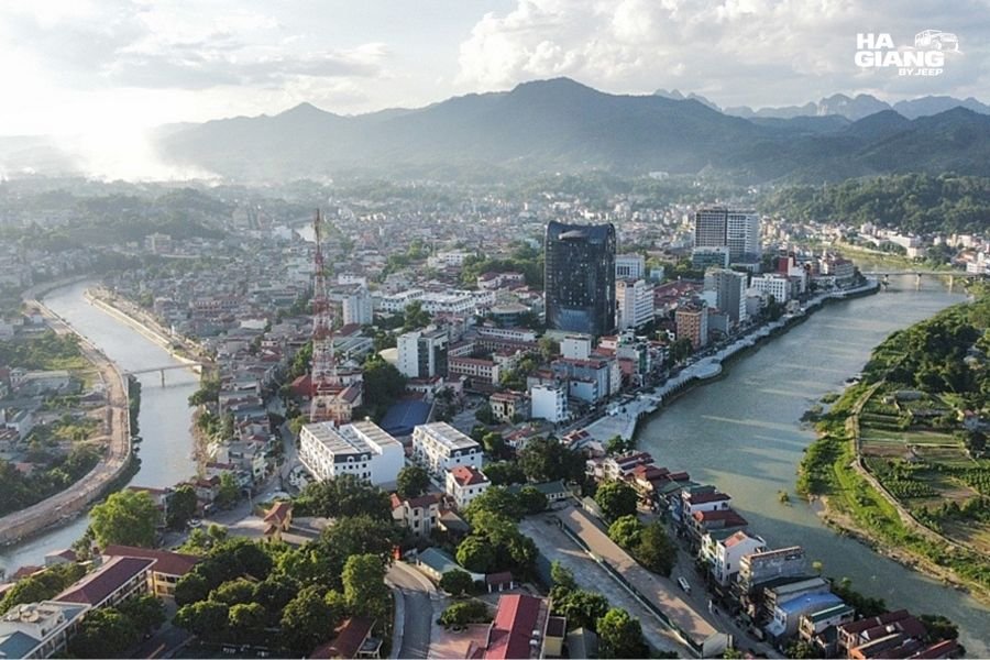
The 15 Step Pass
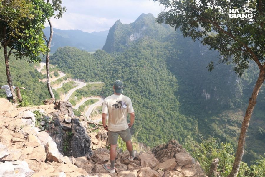
Khau Coc Cha, the 15 step pass, descends through fifteen switchback turns into a valley. Driving it on Day 3 gives you the downhill version: the road unravels in front of you, each bend revealing the next below.
Return to Cao Bang City
Day 3 ends back in Cao Bang City, completing the loop.
Summary Table: 3 Day Cao Bang Loop
| Day | Main stops | Overnight |
|---|---|---|
| Day 0 | Travel to Cao Bang City | Cao Bang City |
| Day 1 | Phia Thap, Dia Tren, Tra Linh fossils, Ba Quang hills | Truong Ha homestay (near Pac Bo) |
| Day 2 | Pac Bo, Phat Tich Pagoda, Ban Gioc Waterfall, Nguom Ngao Cave | Homestay near Ban Gioc |
| Day 3 | Ngoc Con viewpoint, God's Eye Mountain, 15 step pass, return | Departure south or Cao Bang City |
What the 3 Days Version Misses
Three days covers the main Cao Bang Loop. What a fourth day adds:
Thang Hen Lake. A lake at altitude northeast of Cao Bang City with views across the geopark. Half a day, and worth it for travelers who want the fuller landscape picture.
A second morning at Ban Gioc. The falls look different at different hours and in different light. With four days, you can arrive the evening before, see the falls at dusk, and catch the morning again before leaving.
More of the Tay and Nung villages. The three days version passes through the craft villages quickly. A slower day through the western part of the province changes the character of the experience.
The Cao Bang food scene. Cao Bang town has its own food culture, including smoked pork, duck stuffed with herbs and local rice wine that is different in character from the corn wine of Ha Giang. An evening in the town market is something the three days loop leaves out.
Our 4 day Cao Bang Loop itinerary covers what the extra day adds in detail.
Practical Notes
Permits
The Ban Gioc border zone and the Pac Bo area both require a border zone permit. Reputable operators arrange this in advance and include it in the tour. Processing times and requirements can change. Confirm with your operator before travel.
Accommodation
The two nights on the Cao Bang Loop are in local homestays: the first near Pac Bo in the Truong Ha area, the second near Ban Gioc. Both serve home-cooked Tay and Nung food. Standards are simple and comfortable. Privacy and bathroom quality vary; confirm specifics with your operator if this matters for your planning.
Meals
The three-day tour typically includes three breakfasts, three lunches and two dinners. The homestay dinners are the meals most travelers mention specifically. Tay and Nung food is different from Vietnamese city food: more herb-heavy, more freshwater fish, more dishes cooked over wood fires.
Road Conditions
The main roads on the Cao Bang Loop are paved. The 15 step pass and some mountain sections involve switchbacks. Road conditions respond to monsoon season rain. A capable 4x4 with a local driver who knows current conditions is the right choice for the loop regardless of season.
Best Time
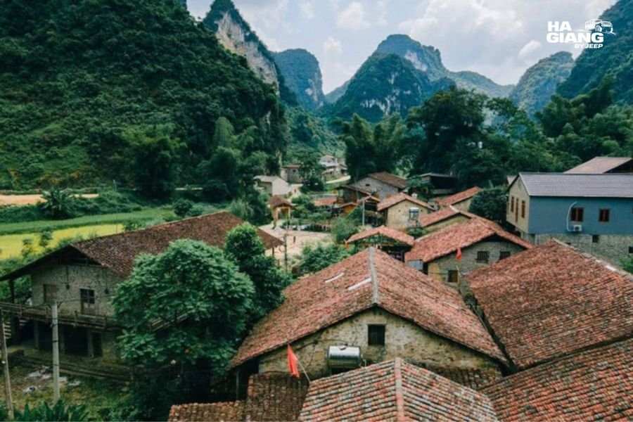
September through November for the highest water at Ban Gioc and post-monsoon clear air. February through April for clear skies, few tourists and lower water levels that show the falls' rock structure. October is the busiest month. See our best time to visit Cao Bang guide for month-by-month detail.
Which Jeep Tour Is Right for You?
The cao bang loop 3 days is included in our combined Ha Giang and Cao Bang tours.
Ha Giang and Cao Bang, 5 days Ha Giang Loop followed by the 3 day Cao Bang Loop. The combined northeast route, finishing in Cao Bang City. The most efficient way to see both provinces.
Ha Giang and Cao Bang, 6 days adds a fourth day in Cao Bang. Thang Hen Lake, more time at Ban Gioc and the geopark more fully covered.
Ha Giang Loop, 3 days or 4 days if Cao Bang is not part of this trip.
Jeep Wrangler Rubicon rental for drivers who want to plan their own route and timing.
With a private Jeep Wrangler Rubicon and a local driver, the cao bang loop 3 days runs on your schedule rather than a group one. You are at Ban Gioc before the morning crowd. You stop at the incense village for as long as it takes. The driver knows which homestay serves the best food and which stall on the road to Pac Bo is worth stopping for.
Questions about combining Ha Giang and Cao Bang, or about doing the Cao Bang Loop as a standalone? Message us on 📍 WHATSAPP with your dates.
Frequently Asked Questions
What is the Cao Bang Loop?
The Cao Bang Loop is a 3 day circuit through the Non Nuoc Cao Bang UNESCO Global Geopark that starts and ends in Cao Bang City. It covers Ban Gioc Waterfall, Nguom Ngao Cave, Pac Bo historical site, God's Eye Mountain, the Phia Thap incense village, Dia Tren paper village, Tra Linh marine fossils and the Ba Quang grass hills.
Does the Cao Bang Loop start from Ha Giang or Cao Bang City?
The standalone Cao Bang Loop starts and ends in Cao Bang City. A Day 0 travel day to Cao Bang City is required before the tour starts at 07:30 on Day 1. If you are doing the combined Ha Giang and Cao Bang trip, you enter Cao Bang from the west via Meo Vac and exit south from Cao Bang City.
What are the two homestays on the Cao Bang Loop?
Day 1 overnight is in the Truong Ha area near Pac Bo. Day 2 overnight is near Ban Gioc Waterfall. Both serve home-cooked Tay and Nung food. The specific homestays depend on availability and current arrangements.
Is a permit needed for the Cao Bang Loop?
Yes. Parts of the route, including Ban Gioc and Pac Bo, sit inside a border zone and require a permit arranged in advance. Reputable operators include this in the tour. Requirements can change: confirm with your operator close to your travel dates.
What makes the Cao Bang Loop different from the Ha Giang Loop?
The Ha Giang Loop is stone plateau, severe karst landscape, high passes and Hmong communities. The Cao Bang Loop is greener, more varied, with river valleys, cave systems, a working waterfall border crossing, and Tay and Nung villages with craft traditions. They are different experiences that complement each other rather than repeat.
How long does the Ban Gioc boat trip take?
The sampan boat trip on the Quay Son River in front of Ban Gioc takes around 20 to 30 minutes. It brings you from the Vietnamese bank close to the base of the lower tier and back. Availability and duration can vary by season and water level; confirm on site.
What is God's Eye Mountain?
Nhin Mat Than, literally "looking at the eye mountain," is a limestone formation in the Non Nuoc Cao Bang Geopark with a natural hole through its peak. From the approach road below, the hole frames the sky. It is one of the most photographed features of the Cao Bang landscape.
Can I do the Cao Bang Loop without doing Ha Giang first?
Yes. The Cao Bang Loop is a complete trip in itself, starting and ending in Cao Bang City. It does not require Ha Giang as a prerequisite. Travelers who want the northeast of Vietnam and have limited time sometimes skip Ha Giang and come directly to Cao Bang.
Ha Giang by Jeep runs private 4x4 tours across the Dong Van Karst Plateau and Non Nuoc Cao Bang Geoparks, with English speaking local drivers and 24/7 support from our office in Ha Giang City. Email booking@hagiangbyjeep.com or WhatsApp +84 862 379 288.
Image Plan (không xuất bản, dùng để gửi link ảnh)
| # | Placeholder | Suggested filename | Scene | SEO alt text |
|---|---|---|---|---|
| 01 | `https://hagiangbyjeep.com/wp-content/uploads/2026/10/Cao-Bang-Loop-3-days_-Ban-Gioc-Waterfall-the-highlight-of-the-route.jpg` | `01-cao-bang-loop-3-days-ban-gioc-waterfall.jpg` | Hero. Ban Giốc toàn cảnh 3 tầng | Cao Bang Loop 3 days: Ban Gioc Waterfall, the highlight of the route |
| 02 | `https://hagiangbyjeep.com/wp-content/uploads/2026/09/Jeep-with-the-soft-top-closed-on-a-misty-day-in-the-Ha-Giang-highlands.jpg` | `02-gods-eye-mountain-non-nuoc-cao-bang-geopark.jpg` | Núi Mắt Thần từ phía dưới | God's Eye Mountain in the Non Nuoc Cao Bang Geopark |
| 03 | `https://hagiangbyjeep.com/wp-content/uploads/2026/10/Ngoc-Con-Valley-on-the-Cao-Bang-Loop-3-day-route.jpg` | `03-ngoc-con-valley-cao-bang-loop.jpg` | Thung lũng Ngọc Con nhìn từ đường | Ngoc Con Valley on the Cao Bang Loop 3 day route |
| 04 | `https://hagiangbyjeep.com/wp-content/uploads/2026/10/The-15-step-pass-in-Cao-Bang-on-the-3-day-loop-itinerary.jpg` | `04-15-step-pass-cao-bang-3-day-itinerary.jpg` | Đèo 15 tầng nhìn từ trên xuống | The 15 step pass in Cao Bang on the 3 day loop itinerary |
| 05 | `https://hagiangbyjeep.com/wp-content/uploads/2026/10/Nguom-Ngao-Cave-near-Ban-Gioc-Waterfall-Cao-Bang.jpg` | `05-nguom-ngao-cave-ban-gioc-cao-bang.jpg` | Hang Nguom Ngao, thạch nhũ và măng đá | Nguom Ngao Cave near Ban Gioc Waterfall, Cao Bang |
| 06 | `https://hagiangbyjeep.com/wp-content/uploads/2026/10/A-bamboo-boat-on-the-Quay-Son-River-below-Ban-Gioc-Waterfall.jpg` | `06-bamboo-boat-quay-son-river-ban-gioc.jpg` | Thuyền tre trên sông Quây Sơn gần thác | A bamboo boat on the Quay Son River below Ban Gioc Waterfall |
| 07 | `https://hagiangbyjeep.com/wp-content/uploads/2026/10/Cao-Bang-town-from-above-the-end-point-of-the-3-day-loop.jpg` | `07-cao-bang-town-from-above.jpg` | Thị trấn Cao Bằng nhìn từ trên cao | Cao Bang town from above, the end point of the 3 day loop |
| 08 | `https://hagiangbyjeep.com/wp-content/uploads/2026/10/Pac-Bo-historical-site-near-the-Chinese-border-Cao-Bang.jpg` | `08-pac-bo-historical-site-cao-bang.jpg` | Di tích Pac Bó, suối Lênin và hang | Pac Bo historical site near the Chinese border, Cao Bang |
| 09 | `https://hagiangbyjeep.com/wp-content/uploads/2026/10/A-private-jeep-on-a-mountain-road-on-the-Cao-Bang-Loop.jpg` | `09-private-jeep-mountain-road-cao-bang.jpg` | Xe jeep riêng trên đường núi Cao Bằng | A private jeep on a mountain road on the Cao Bang Loop |
| 10 | `https://hagiangbyjeep.com/wp-content/uploads/2026/10/Khuoi-Ky-ancient-stone-village-on-the-Cao-Bang-Loop.jpg` | `10-khuoi-ky-stone-village-cao-bang-loop.jpg` | Làng đá cổ Khuổi Kỳ | Khuoi Ky ancient stone village on the Cao Bang Loop |
| 11 | `https://hagiangbyjeep.com/wp-content/uploads/2026/10/A-winding-mountain-road-on-the-Cao-Bang-3-day-itinerary.jpg` | `11-winding-mountain-road-cao-bang-3-days.jpg` | Đường núi quanh co Cao Bằng | A winding mountain road on the Cao Bang 3 day itinerary |
| 12 | `https://hagiangbyjeep.com/wp-content/uploads/2026/10/The-Quay-Son-River-near-Ban-Gioc-Waterfall-Cao-Bang-Vietnam.jpg` | `12-quay-son-river-near-ban-gioc-cao-bang.jpg` | Sông Quây Sơn gần thác Bản Giốc | The Quay Son River near Ban Gioc Waterfall, Cao Bang Vietnam |