
Ha Giang vs Cao Bang: How the Two Provinces Actually Differ, and How to Choose
They are two hours of driving apart and they look like different countries.
Ha Giang vs Cao Bang comes up constantly from travelers planning the far north, usually phrased as which one is better. That is the wrong question and it has no answer, because the two provinces are not competing versions of the same thing. One is vertical grey limestone with maize growing out of the rock. The other is rivers and rice valleys between rounded karst hills. Both hold a UNESCO Global Geopark. They photograph completely differently and they feel completely different to be in.
This guide compares them properly, then reframes the question, because for most people planning a trip from Hanoi the genuine decision is not which province. It is how many days they have.
What is in this guide
- The short answer
- Side by side
- How the two landscapes actually differ
- The signature sight in each
- Crowds, and what that is worth to you
- The driving
- Route structure: a loop and a hub
- Culture and villages
- Season sensitivity
- Photography
- Which suits older or mixed ability travelers
- The question you are actually asking
- What we do and do not sell
- Which jeep tour is right for you?
- FAQ
The short answer
Choose Ha Giang if you have a shorter trip, you want the most dramatic mountain scenery in Vietnam, and the classic loop with its passes and markets is what drew you north in the first place.
Choose Cao Bang if you have already done Ha Giang, or if waterfalls, rivers, caves and quiet green valleys appeal to you more than bare rock and high passes, and you have the days for a slower trip.
Do both if you have a week or more for the north. They complement each other rather than repeating each other, which is why we run them as one trip rather than as alternatives.
That is the whole decision. The rest of this article is the detail behind it.
Side by side
| Ha Giang | Cao Bang | |
|---|---|---|
| Geopark | Dong Van Karst Plateau | Non Nuoc Cao Bang |
| Landscape | Vertical, bare, grey. Deep canyons, high passes | Horizontal, green, wet. Rivers, rice valleys, rounded karst |
| Signature sight | Ma Pi Leng Pass above the Nho Que River | Ban Gioc Waterfall on the border river |
| Farming you see | Maize in pockets of soil between rocks | Rice in flat valley floors |
| Water features | Almost none, aside from the Nho Que canyon | Waterfall, lakes, caves, rivers throughout |
| Route shape | A genuine circular loop from Ha Giang City | A hub with spokes from Cao Bang City |
| Visitors | Busy, especially in autumn | Far fewer, almost anywhere outside Ban Gioc |
| Driving | Higher, narrower, more exposed | Lower, wider, gentler |
| Main communities you meet | Hmong dominant on the plateau | Tay and Nung more prominent alongside Hmong |
| Villages | Old quarter towns, stone and clay houses on slopes | River villages, stilt houses, valley settlements |
| Markets | Dong Van and Meo Vac on Sunday, plus moving village markets | Smaller, quieter, less visited |
| Best for | First trip north, big scenery, market mornings | Second trip north, water and green, quiet driving |
How the two landscapes actually differ
The single most useful thing to understand, and the reason doing both is not repetition.
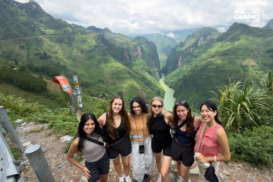
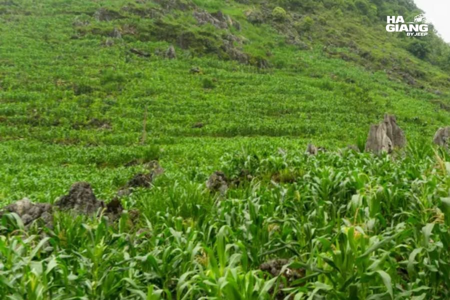
Ha Giang is what happens when limestone goes up. The Dong Van plateau is towers and blades of bare grey rock with almost no soil and almost no surface water, because limestone drains. Farming means carrying soil by hand into cracks and planting maize in it. The drama is in height and drop, and the roads run along the edges of it.
Cao Bang is what happens when limestone sits in water. Rounded karst hills standing in flat green valleys, rivers running between them, rice in the valley floors, buffalo in the fields. Waterfalls and caves because there is water moving through the rock. The drama is in the composition rather than the exposure.
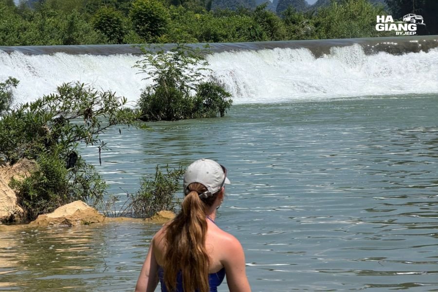
Same geology, opposite expression. If you have seen photographs of both and thought they looked like different countries, you were reading them correctly.
Not sure which fits your trip?
Send us your dates and how many nights you have in the north, and we will tell you honestly whether Ha Giang alone is the better use of your time or whether the days stretch to both.
The signature sight in each
Worth comparing directly, because for a lot of people this decides it.
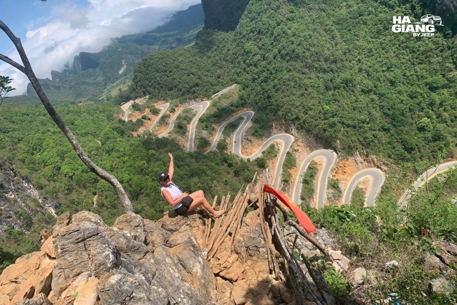
Ma Pi Leng Pass is a road cut into a cliff face high above the Nho Que River, connecting Dong Van and Meo Vac. It is the most spectacular stretch of road in Vietnam and it is spectacular from the vehicle, which means you get all of it without walking anywhere. There is an optional boat trip at the bottom of the canyon.
Ban Gioc Waterfall is wide and tiered, on the Quay Son River which forms the border with China at that point. Bamboo rafts take you out onto the water below the main tier and the viewing areas are paved and flat.
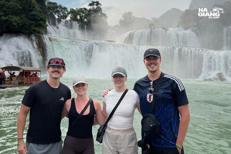
The honest difference: Ma Pi Leng looks the same all year and Ban Gioc does not. Waterfall flow varies enormously with the season, so the version you see depends heavily on your dates. Volume and power in the wet months, clearer water and a more defined shape in the dry. Neither is wrong, but if Ban Gioc is the reason you are going to Cao Bang, ask us which version your dates will give you.
Crowds, and what that is worth to you
The clearest practical difference between the two provinces.
Ha Giang has become considerably more visited over recent years. The plateau is large and it absorbs people, but the popular viewpoints at popular hours are busy, and accommodation in the good places fills well ahead in autumn.
Cao Bang sees a fraction of that. Outside the Ban Gioc car park, most of the province is genuinely quiet. You can drive the Ngoc Con Valley and pass almost nobody.
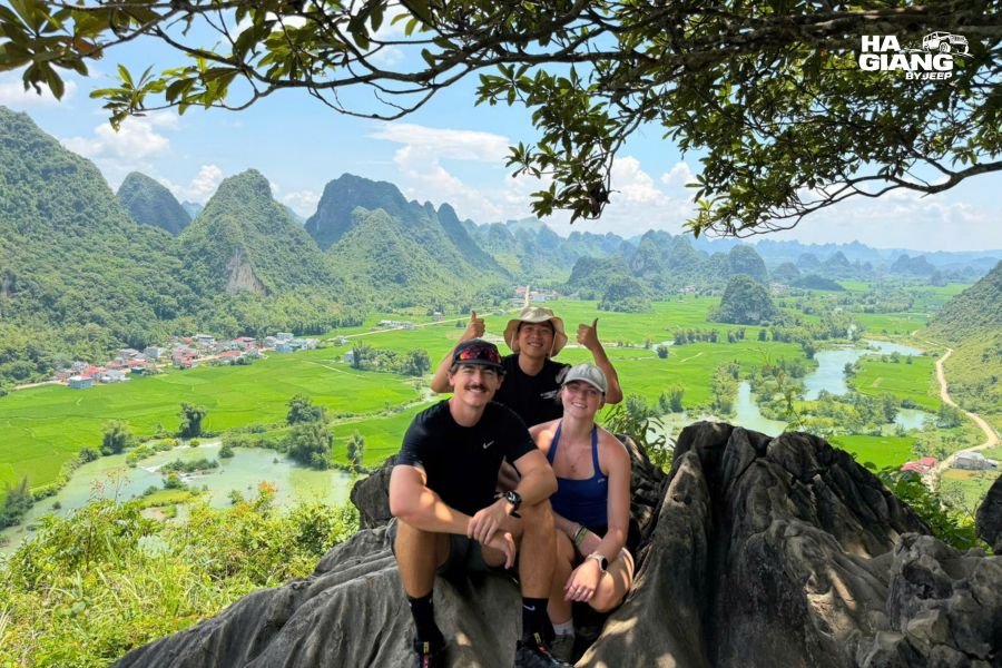
How much that matters is personal. If you came for landscape photography or for quiet, it is a real argument for Cao Bang. If you came for markets, for the social side of the region and for the sense of a place that is fully alive, Ha Giang's busier plateau is where that is.
The driving
Ha Giang is the harder drive: higher, narrower in places, more exposed, with genuine drops and no barrier on some sections. Fog on Ma Pi Leng can arrive with very little warning. It is entirely manageable with a driver who does it weekly, and it is the thing people find most tiring when they do it themselves.
Cao Bang is gentler. Lower, wider, less exposed. If somebody in your group found the Ha Giang passes hard work, the eastern half of a combo trip is the easier half rather than more of the same.
Road repair work happens in both provinces, most often in and after the wet months, and it reorders a day rather than cancelling a trip. Conditions change through the year, so check current local updates rather than assuming.
Route structure: a loop and a hub
An underrated difference that affects your itinerary more than anything else on this page.
Ha Giang is a real loop. You leave Ha Giang City, drive a circuit through Quan Ba, Yen Minh, Dong Van, Ma Pi Leng and Meo Vac, and come back. Very little repeated road.
Cao Bang is a hub with spokes. Cao Bang City sits in the middle and the good places are on separate roads running out from it: east to Ban Gioc, northwest to Pac Bo, south to the Thang Hen lakes, west toward Bao Lac. A spoke gets driven twice. A loop does not.
That is why people who plan Cao Bang like Ha Giang end up repeating roads, and it is why our combo tours arrive from Ha Giang along the western corridor and finish in Cao Bang City, which turns the whole thing into one line rather than a set of out and back runs. The Cao Bang Loop guide works through the route options in full.
Culture and villages
Both provinces are home to several ethnic communities and both are worth visiting for that alone.
On the Ha Giang plateau the Hmong are dominant. Rammed earth houses with tile roofs and dry stone walls, indigo hemp textiles, maize as the staple, and market mornings that function as the region's social system. Our Hmong culture guide covers this properly.
In Cao Bang, Tay and Nung communities are more prominent alongside Hmong and others, and the settlement pattern follows the rivers rather than the slopes. Stilt houses, valley villages, rice rather than maize.
Markets are the clearest difference. Ha Giang's are bigger, busier and better known, with Dong Van and Meo Vac both on Sunday morning and several village markets running on a lunar cycle that shifts them week to week. Cao Bang's are smaller and quieter, including Bao Lac on the western side. Our market days guide explains how the timing works.
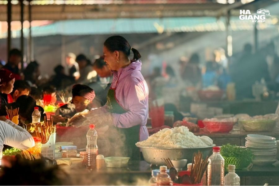
If markets are a priority, that is a point for Ha Giang.
Season sensitivity
Both are worth visiting year round and they respond to the seasons differently.
Ha Giang's calendar highlight is the buckwheat bloom, usually from around late October into November, which is also the busiest and clearest window. Winter is cold, bare and dramatic with valley mist at sunrise. Summer is green and wet.
Cao Bang's big variable is water. Ban Gioc is at its most powerful in the wet months and at its clearest in the dry. Rice in the valleys turns gold around autumn, which is the province at its most photogenic. Winter is cold and quiet, particularly in the higher western districts.
The practical planning point: if your dates are fixed and you want the buckwheat, that is Ha Giang and a specific narrow window. If your dates are fixed and you want the waterfall at full flow, that is Cao Bang in the wet months, which is also when road repairs are most likely. Tell us your dates and we will tell you what they actually get you.
Photography
Different palettes, different techniques, and a reason to do both if photographs are the point of the trip.
Ha Giang is bare rock, high contrast, big drops and long light. Wide for the canyon, long for the stacked ridges and switchback roads. Cold clear mornings give valley cloud, which is the best thing that happens there.
Cao Bang is green, layered and soft. Rivers, rice, reflections, waterfall long exposures, karst hills receding into haze. It suits flat light better than Ha Giang does, which is useful because you cannot rely on clear skies.
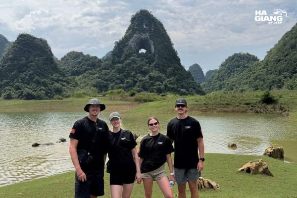
Doing both in one trip is also weather insurance. Two regions rarely have a bad week at the same time. Our photography guide has the light and timing for the major stops.
Which suits older or mixed ability travelers
Cao Bang, marginally, and for three specific reasons: the driving is gentler, the main sights at Ban Gioc are on paved flat ground, and the driving days on the longer combo tours are shorter rather than longer.
Ha Giang is entirely manageable too. Almost all the scenery is roadside and the stops that require effort are optional. Our senior travelers guide has the effort level for every major stop, and the guide for adult children planning a trip with parents covers the family side.
The honest recommendation for a mixed ability group with a week available: the 6 days combo. It is the gentlest itinerary we run, not the hardest, because the same distance is spread across more days.
The question you are actually asking
Here is the reframe, and it is the most useful thing in this article.
Almost everybody who asks Ha Giang or Cao Bang is coming from Hanoi with a fixed number of days and no strong prior knowledge of either. For that traveler, the province is not really the variable. The variable is time.
| Days available in the north | What actually makes sense |
|---|---|
| 3 to 4 days | Ha Giang only. The loop, done properly. Cao Bang does not fit and forcing it ruins both |
| 5 days | Ha Giang plus the Ban Gioc corner of Cao Bang, on the 5 days combo |
| 6 days or more | The full combo, both Geoparks, shortest driving days, most time standing still |
| A second trip north | Cao Bang led, since you have already seen the plateau |
Notice that at no point does the answer become "Cao Bang instead of Ha Giang" for a first visit from Hanoi. That is not us being partisan. It is geography: the corridor between the provinces runs through Ha Giang, so a Cao Bang first trip means driving past the plateau to get to the quieter province, which very few first time visitors actually want.
What we do and do not sell
Plain, because it affects what you can book from us.
We do not sell a Cao Bang only tour. Our Cao Bang itineraries are the 5 days 4 nights and 6 days 5 nights combos, both starting with the Ha Giang Loop and finishing in Cao Bang City.
That is not a sales device. Our office and our vehicles are in Ha Giang City, the western corridor is the natural link between the provinces, and running a Cao Bang only trip from our base would mean a long empty drive at each end that you would be paying for.
If Cao Bang alone is genuinely what you want, tell us. We will say honestly what we can and cannot do rather than steering you into the combo. There is also the Wrangler Rubicon rental if you want to drive the province yourself, though foreign driver requirements in Vietnam can change and you should check current rules first.
We would rather lose a booking than take one that was the wrong shape for the trip you wanted.
Send us your dates and your total days in Vietnam
We will tell you which province, which length, and whether the combo is worth it or whether you would be better spending the time on Ha Giang properly. Email booking@hagiangbyjeep.com if you prefer.
Which jeep tour is right for you?
Ha Giang Loop, 4 days 3 nights. The right answer for most people choosing between the two provinces for the first time. The classic loop with room in it, plus Lung Cu and Du Gia, and space to build the route around a market morning. See the 4 days tour
Ha Giang Loop, 3 days 2 nights. Ha Giang only, for a fixed window. Full but not frantic. See the 3 days tour
Ha Giang and Cao Bang, 5 days 4 nights. Both provinces, both Geoparks, with Cao Bang concentrated on the Ban Gioc corner. The shortest way to see the contrast. Finishes in Cao Bang. See the 5 days tour
Ha Giang and Cao Bang, 6 days 5 nights. The one to book if Cao Bang is genuinely pulling at you. The western road through Bao Lac and the 15 level pass, plus Pac Bo, God's Eye Mountain and Ngoc Con Valley, at the gentlest pace we run. See the 6 days tour
Jeep Wrangler Rubicon rental. 5,000,000 VND per day for the vehicle, about $192. For confident drivers with the right paperwork. Check the current rules for foreign drivers before planning around it. See rental details
If this is your first trip to Vietnam, the first time visitors guide covers whether the north belongs on your itinerary at all and what it displaces.
Ha Giang vs Cao Bang FAQ
Ha Giang or Cao Bang, which is better?
Neither, because they are not the same kind of place. Ha Giang is vertical grey limestone with high passes and big markets. Cao Bang is rivers, rice valleys, waterfalls and caves, with far fewer visitors. Pick by what appeals, or do both if you have a week.
Can I visit both Ha Giang and Cao Bang in one trip?
Yes, and it is how we run them. The 5 days combo covers the Ha Giang Loop plus the Ban Gioc corner. The 6 days version takes the longer western road through Bao Lac and adds Pac Bo, God's Eye Mountain and Ngoc Con Valley.
How far apart are Ha Giang and Cao Bang?
They are neighbouring provinces linked by a western road corridor through Bao Lac. That corridor is the route our combo tours take, and it includes the 15 level pass on the 6 days version.
Is Cao Bang worth visiting if I have already seen Ha Giang?
Yes, and this is the strongest case for it. The two look nothing alike, so Cao Bang is a genuinely new landscape rather than more of the same. For a second trip north, Cao Bang led makes sense.
Which is less crowded, Ha Giang or Cao Bang?
Cao Bang, substantially. Outside the Ban Gioc area most of the province is quiet, where Ha Giang's popular viewpoints get busy at popular hours and autumn accommodation fills early.
Which has better scenery?
Ha Giang is more dramatic, Cao Bang is more varied. Ha Giang gives you the most spectacular road in Vietnam at Ma Pi Leng. Cao Bang gives you a waterfall, caves, lakes and rice valleys. It depends entirely on which of those you would rather look at.
Which is easier to travel in?
Cao Bang. The roads are lower, wider and less exposed than the Ha Giang passes, and the driving days on the longer combos are shorter. If mobility or motion sickness is a concern for anyone in your group, that matters.
Do you offer a Cao Bang only tour?
No. Our Cao Bang itineraries are the 5 days and 6 days combos, both starting with the Ha Giang Loop. Our vehicles and office are in Ha Giang City, so a Cao Bang only trip would mean long empty drives you would be paying for. Ask us and we will be honest about the options.
How many days do I need for both?
Five at minimum, six if Cao Bang is a real priority rather than an addition. Under five days, do Ha Giang properly instead of doing both badly.
Which is better for photography?
Both, differently. Ha Giang is high contrast bare rock, big drops and valley mist on cold mornings. Cao Bang is green, layered and soft, and it handles flat light better. Doing both is also weather insurance.
When is Ban Gioc Waterfall at its best?
The wet months give the most volume and power, the drier months give clearer water and a more defined shape. They are different photographs rather than better and worse. Ask us which your dates will give you.
Which province should I choose for a first trip to Vietnam?
Ha Giang, almost always. The corridor between the provinces runs through it, the loop is a self contained circuit, and it is what most people came north for. Save Cao Bang for a longer trip or a second visit.