
Ban Gioc Waterfall Guide: When to Go and What to See
The largest waterfall in Vietnam sits on an international border, in a province most first time visitors never reach. Here is how to see it properly, and how to get there without wearing yourself out.
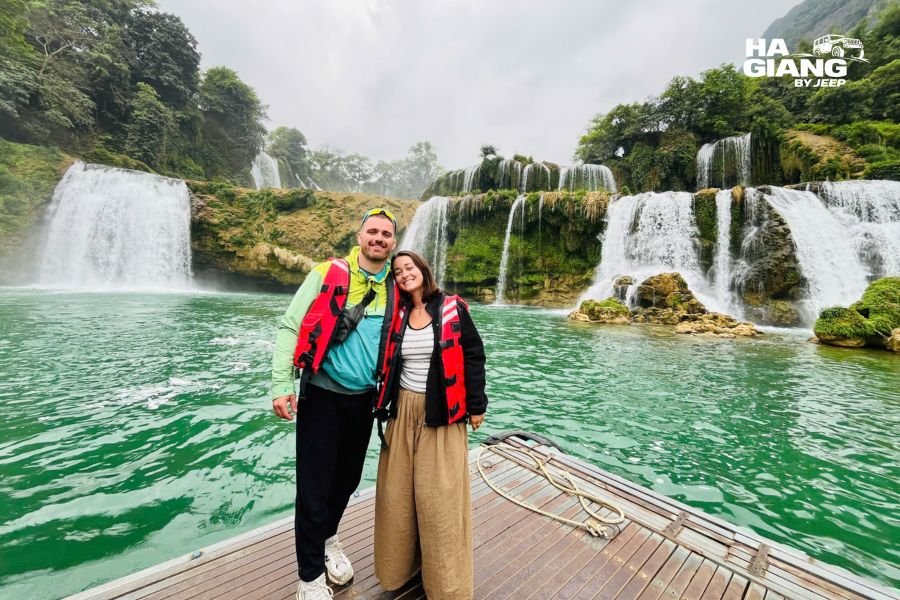
You hear Ban Gioc Waterfall before you see it. The lane from Trung Khanh runs flat and green through rice fields and bamboo, so ordinary that passengers usually stop paying attention. Then the trees thin out, the sound arrives, and there it is: a wide staircase of white water dropping into the Quay Son River, with limestone peaks stacked behind it like painted stage scenery. Vietnam on one bank, China on the other. Nobody stays quiet at that first view.
We drive guests to this corner of the far northeast on our longer trips, and it is consistently the moment people talk about at dinner. Not because it is the tallest waterfall anyone has seen, because it is not, but because of the setting. Cattle graze on the lawn in front of it. Someone is cutting grass with a scythe fifty metres from one of the most photographed views in Southeast Asia. It feels unpolished in the best way.
This guide is written for the travellers we usually carry: couples, families, small groups of friends, and plenty of people in their fifties, sixties and beyond who want the northeast without a punishing schedule. It covers the seasons, the practicalities, what to do when you arrive, and what else is worth your time in the valleys around Ban Gioc Waterfall.
One promise up front. You will not find invented driving times, ticket prices or permit rules here. Those change, sometimes with very little notice, and a confident number in a blog post is worth nothing at the barrier. Where something is variable, we say so and tell you how to check.
Why Ban Gioc Waterfall Is Worth the Distance
Cao Bang province is a long way from anywhere on the standard Vietnam route. That is exactly why it is still good.
Ban Gioc Waterfall is the widest waterfall in Vietnam and, by most accounts, the largest natural waterfall along any national border in Asia. Published figures for its height and width vary quite a bit between sources, partly because the river changes shape so dramatically with the season. What matters more is the shape of it: rather than one single plunge, the water spreads across a broad limestone shelf and steps down in tiers, splitting into separate curtains and rejoining below. In high water the tiers merge into one continuous wall. In low water they separate into distinct ribbons over green ledges.
The second reason to come is everything around it. Cao Bang is a UNESCO Global Geopark, Non Nuoc Cao Bang, and the landscape between the falls and the provincial capital is a slow parade of limestone towers, clear rivers and villages that see very few foreign faces. Travellers who add Cao Bang to a Ha Giang trip almost always tell us the second half felt quieter and more rural, even after the drama of the Dong Van Karst Plateau.
The third reason is simple honesty about crowds. Ban Gioc Waterfall does get busy, especially at weekends and during Vietnamese holidays, and the viewing lawn can fill with tour groups by late morning. It is still nothing like the crush at Vietnam's coastal headline sights, and if you arrive early or stay late you will often have long stretches of quiet.
Where Ban Gioc Waterfall Sits, and Why the Border Matters
Two banks, two countries
The falls sit on the Quay Son River in Trung Khanh district, Cao Bang province, in the far northeast of Vietnam. The river forms the international boundary here, which means the same body of water is called Ban Gioc in Vietnam and Detian on the Chinese side. From the Vietnamese viewing lawn you can see visitors on the opposite bank, and boats from both countries work the pool below the main tier.
This is a working border zone, not a theme park. There are markers, patrol paths and rules about where you can and cannot walk, and those rules are enforced politely but firmly. Cross border tourism arrangements between the two sides have been trialled and adjusted over the years, so anything you read about walking across, buying a combined ticket or visiting both banks in one day should be treated as possibly out of date. Check the latest updates close to your travel dates, or ask us and we will confirm what is actually happening on the ground that week.
Cao Bang in context
Cao Bang City is the provincial capital and the usual base for the region, though there are also guesthouses, homestays and a couple of resorts much closer to Ban Gioc Waterfall in Trung Khanh and the surrounding valleys. The province shares its northern edge with China, which is why border formalities and identification come up more often here than they do elsewhere in Vietnam.
For most itineraries, Ban Gioc Waterfall works best as the far point of a loop rather than a there and back errand. You come in through one valley and leave through another, picking up Nguom Ngao Cave, the Ngoc Con and Phong Nam valleys, and often Pac Bo along the way.
Best Time to Visit Ban Gioc Waterfall
There is no single perfect month, only trade offs. Water volume, rice colour, sky clarity and crowd levels all peak at different times, and the honest answer depends on which of those you care about most.
The wet months: maximum power
Roughly from May through September the region gets its heaviest rain, and the Quay Son runs high. This is when Ban Gioc Waterfall looks the way it does in the postcards: one enormous, thundering curtain with spray drifting far across the lawn. The water often carries silt and turns a milky brown or ochre after storms, which some people love and others find disappointing after seeing turquoise photos online.
Practical notes for this window. Raft trips can be suspended when the river is too high or too fast. Roads in the wider region are more prone to slips and repairs after heavy rain, and afternoon downpours are common. None of that makes travel unpleasant in a covered vehicle, but it does mean a flexible plan is worth more than a rigid one.
Late September and October: the sweet spot
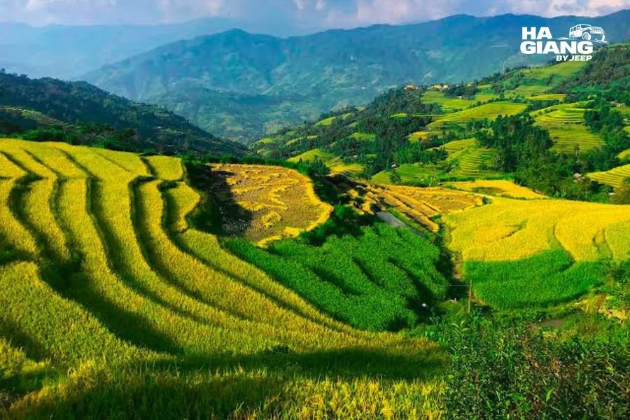
If we had to name one window, this is it. Rain is easing but the river is still generous, so you get volume without the worst of the mud. The rice around Trung Khanh, Ngoc Con and Phong Nam turns gold, and the chestnut harvest starts in Trung Khanh. Skies tend to open up between showers, and the light in the valleys is superb in the first and last hours of the day.
This is also when domestic tourism peaks at weekends, so a weekday visit pays off.
November through April: clarity and quiet
Water levels drop, Ban Gioc Waterfall separates into distinct tiers, and the Quay Son turns a startling jade green. Photographers who want that colour come now. Mornings can be cold and misty in December and January, which is atmospheric at the pagoda viewpoint but sometimes hides the far bank entirely until the sun burns through.
Spring brings a second small window: from around late February the valleys green up, plum and pear blossom appears in the higher districts, and the crowds are thin before the summer domestic season starts.
| Window | River | Landscape | Trade off |
|---|---|---|---|
| May to September | Highest volume, one wide curtain | Deep green, growing rice | Silty water, rain, raft trips may pause |
| Late September to October | Strong but settling | Golden rice, chestnut season | Busy at weekends |
| November to February | Low and clear, jade colour | Dry, misty mornings | Falls look narrower, cold early |
| March to April | Moderate, clearing | Fresh green, blossom higher up | Haze on some days |
So when should you actually go?
If you want the waterfall at full power, aim for August or September. If you want the best all round trip, with good water and beautiful surroundings, target late September or October. If you want jade water, empty viewpoints and cool clear air, come between November and February and accept a narrower waterfall.
Every one of those months has produced trips our guests loved. The season shapes the photographs, not the quality of the day.
How to Get to Ban Gioc Waterfall
Coming from Hanoi
Cao Bang province is northeast of Hanoi, and Ban Gioc Waterfall is a further stretch beyond the provincial capital, out towards the border. Almost everyone treats the journey from Hanoi as a full travel day rather than something to squeeze around other plans, and the last section from Cao Bang City out to the falls is scenic enough that you will want daylight for it.
Public options exist, with sleeper buses to Cao Bang City and local transport onward, but connections are infrequent and inflexible. The most common frustration we hear from independent travellers is not the distance, it is arriving at the falls in the middle of the day with a fixed departure time and no way to stop for the valleys on the way.
We deliberately do not publish stop to stop driving times, and we would gently suggest not trusting sources that do. Roadworks, weather and seasonal traffic change these numbers constantly, and an out of date figure is how people end up rushing.
Coming from Ha Giang
This is the route we drive most. Rather than returning to Hanoi and starting again, the two provinces connect through Bac Me, Bao Lam and Bao Lac, then over the high passes of western Cao Bang towards Nguyen Binh and the capital.
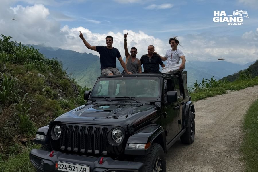
It is a spectacular stretch of road and one of the most rewarding drives in the north, taking in the 15 step pass at Khau Coc Cha and long sections of empty mountain highway. It also takes real time, which is why the combined trips run five or six days rather than trying to bolt Ban Gioc Waterfall onto a short loop. If you are weighing the two, our 5 days Ha Giang and Cao Bang jeep tour covers the essentials and finishes at the falls, while the 6 days version adds slower days in the villages and more time in the Cao Bang valleys.
Why the road matters more than the distance
Distances in the northeast are misleading. A short number of kilometres on a map can mean a long sequence of climbs, hairpins and villages, and that is the point rather than the problem. The stops between places are frequently better than the destinations.
On the Cao Bang side this is especially true. The Quay Son valley below Trung Khanh, the bamboo groves at Ngoc Con and the limestone bowl at Phong Nam are all worth a proper pause, and a private vehicle means you take them at your own speed. When you travel with a driver who grew up in these mountains, the stops tend to happen in the right places: a viewpoint that only works in morning light, a bridge where the river turns green, a stall selling roasted chestnuts in season.
What to Do When You Arrive
The lawn and the lower viewpoints
The main viewing area is a broad flat lawn on the Vietnamese bank, reached on foot from the ticket gate through a short landscaped stretch. It is genuinely easy walking, which is one reason Ban Gioc Waterfall suits families with young children and travellers who are not confident on rough ground. Buffalo often graze right in front of the water, and photographers spend a lot of time waiting for one to stand in the right place.
Walk to the far right of the lawn for the classic wide angle with the full tiered face, then work back along the river bank for closer frames of the lower cascades. The spray reaches surprisingly far in high water, so keep a cloth handy for your lens.
The bamboo raft trip
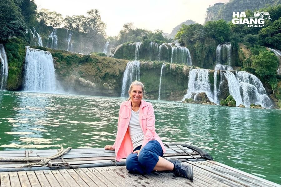
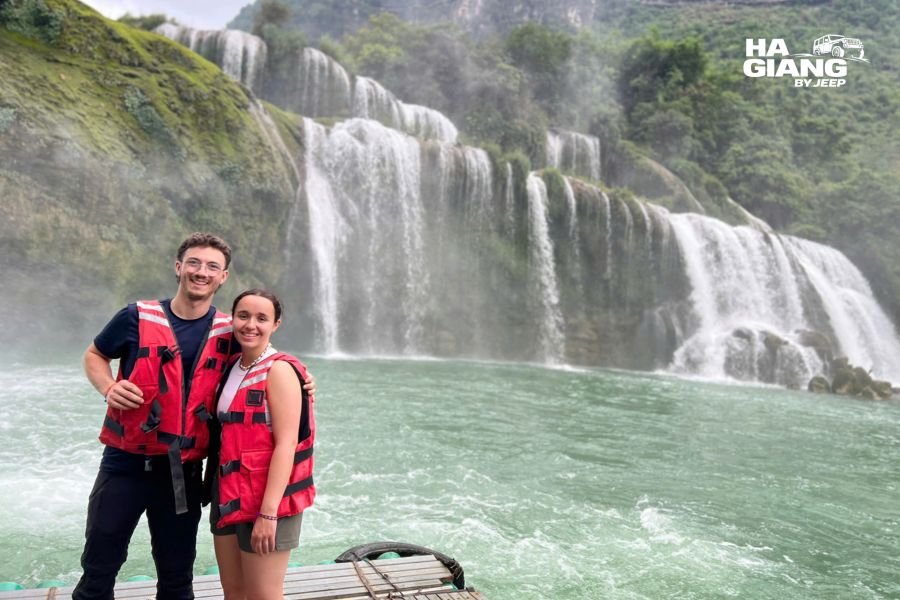
Flat bamboo rafts operate from the Vietnamese bank and take small groups out towards the base of the main tier. This is the closest you can legally get to the water, and it is the highlight of the visit for most people: the noise, the cold spray and the sheer scale of the thing from below.
Operation depends on water levels and conditions, so it is not guaranteed on any given day, particularly in the highest water of the wet season or after storms. Wear something you do not mind getting damp and keep phones in a pocket that closes.
The upper terraces and the border marker
Paths lead up along the Vietnamese side to higher viewpoints where you can look down the length of Ban Gioc Waterfall and across the river. Signs mark where visitors may and may not go, and there are boundary markers in the area that people photograph. Read the signage, stay on the marked paths, and treat instructions from officials as non negotiable. This is the one part of a Cao Bang trip where improvising is a bad idea.
Truc Lam Phat Tich Ban Gioc Pagoda
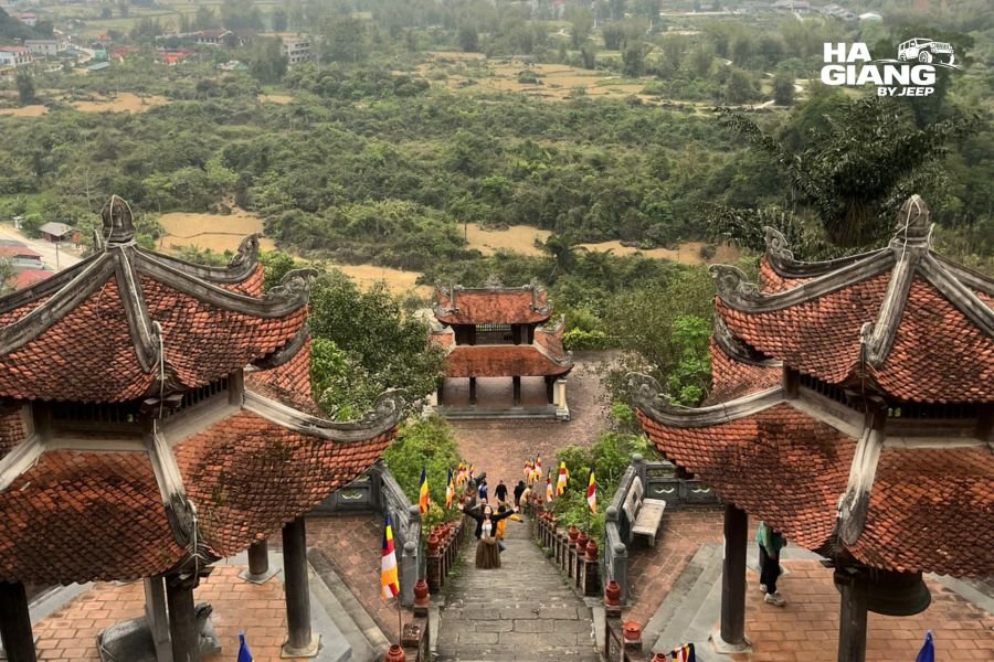
On the hillside above the falls sits a modern Buddhist pagoda complex with terraced courtyards and, from the upper levels, the best elevated view of the whole scene. There is a climb involved, taken at your own pace on steps and ramps, and it is worth it for the perspective: the river bending in from the left, the tiers spread out below, and the karst wall of the far bank filling the background.
Early morning is the quietest time here, and in the cool months mist frequently sits in the valley below the terraces.
What Else to See Nearby
A common mistake is treating the waterfall as the whole trip. The valleys around it are the reason to stay a night rather than pass through.
Nguom Ngao Cave
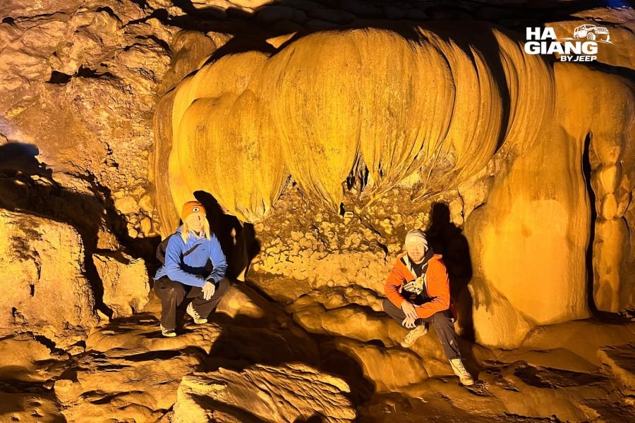
A few minutes from Ban Gioc Waterfall, Nguom Ngao Cave is a large limestone system with a lit walkway through chambers of stalactites, flowstone curtains and formations that guides have given names to over the years. The name comes from the Tay language and refers to tigers, which locals say once sheltered in the entrance.
It is cool inside, the floor can be damp, and the walkway involves steps. Most visitors combine it with the falls in the same half day, which works well: bright open landscape, then cool dark cave, then back out into the valley.
Mat Than Mountain, the God's Eye
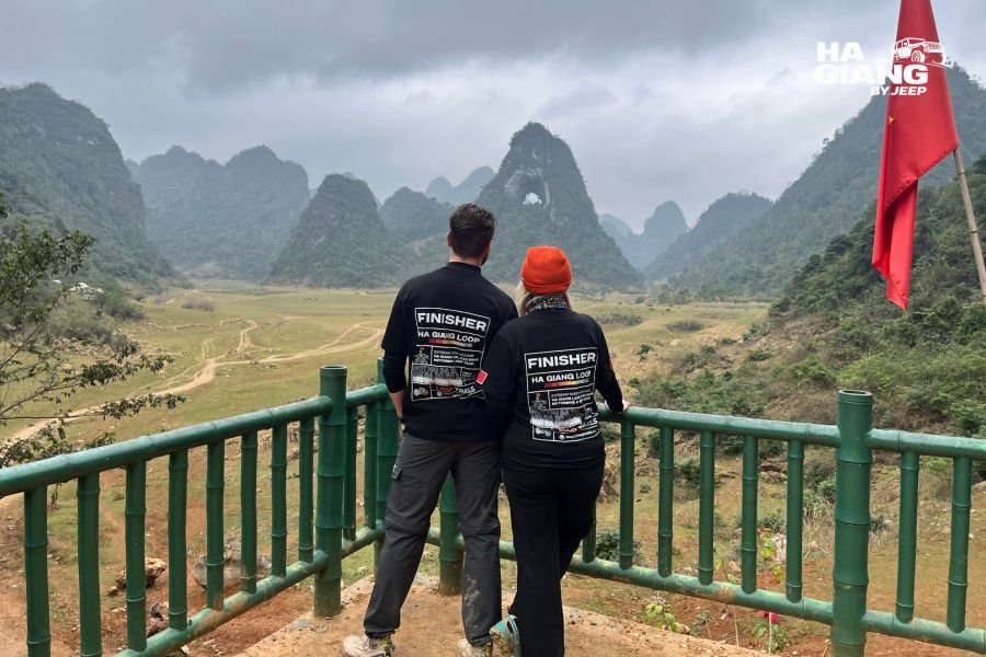
Out towards Quoc Toan and Tra Linh stands a limestone peak with a clean hole punched straight through it near the summit, known as Mat Than or the God's Eye Mountain. Below it sits a seasonal lake and a broad grassy plain where horses and cattle graze, and in the wetter months the water reflects the peak almost perfectly.
The plain drains through the dry season and changes character completely, so what you see depends heavily on when you come. It is one of the most photogenic spots in the province and still far less visited than Ban Gioc Waterfall.
Ngoc Con Valley and Phong Nam
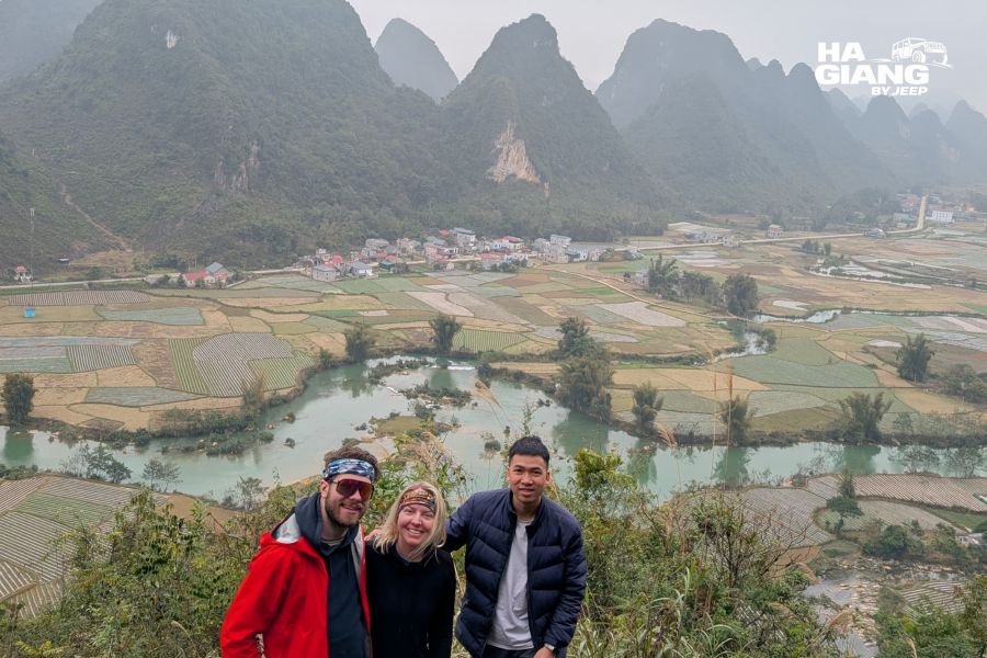
These two valleys, both on the Quay Son, are where the Cao Bang countryside is at its most photogenic: bamboo leaning over clear green water, limestone towers rising straight out of rice fields, wooden houses on stilts and very little traffic. Phong Nam in particular has become a favourite quiet stop, and in the golden weeks of late September and October it is exceptional.
Neither valley has much in the way of formal attractions. That is the appeal. You stop where the view opens up, walk a lane for twenty minutes, and go on.
Pac Bo Historical Site
In the northwest of the province near Ha Quang, Pac Bo is where Ho Chi Minh based himself after returning to Vietnam in 1941. The site includes the cave he used, a stream and a mountain he named after Lenin and Marx, and a museum. For Vietnamese visitors it is a place of real significance, and it is busy with domestic groups and school trips.
Foreign travellers get a different value from it: a peaceful wooded valley, a clear stream, and a useful window into how modern Vietnamese history is remembered. It sits away from the Ban Gioc side of the province, so it usually needs a dedicated half day on a longer trip.
Khau Coc Cha, the 15 step pass
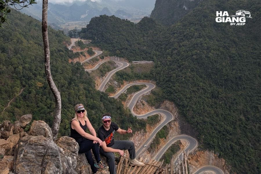
Out west in Bao Lac district, the pass known locally as the 15 step pass stacks its hairpins up a steep hillside in a series of switchbacks that photograph beautifully from the viewpoint above. It sits on the corridor between Ha Giang and Cao Bang, which means guests on our combined trips see it on the way through rather than making a special journey.
What to Eat Around Ban Gioc and Cao Bang
Cao Bang has its own food identity, distinct from the Dong Van plateau, and it is worth arriving hungry.
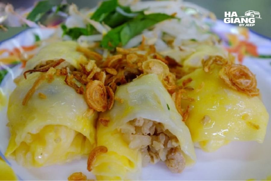
Start with banh cuon Cao Bang. Elsewhere in Vietnam these steamed rice rolls come with a dipping sauce. Here they arrive sitting in a bowl of hot pork bone broth, often with an egg cooked inside the roll and a spoonful of chilli and herbs on top. On a cold morning near the border it is close to perfect.
Other things to look for:
- Vit quay bay vi, seven flavour roast duck, a Cao Bang speciality with a marinade tucked inside the cavity
- Hat de Trung Khanh, the local chestnuts, roasted at the roadside in autumn and genuinely different from imported ones
- Banh khao, a sticky rice and sesame sweet wrapped in paper, sold around markets and Tet
- Com lam, sticky rice cooked in bamboo, common across the northern mountains
- Ruou ngo, corn wine, poured generously at homestay dinners
Markets are where this comes together. If your dates line up with a local market morning anywhere in Trung Khanh or the surrounding communes, go. Market days follow local cycles rather than a fixed weekly calendar, so ask locally or check with us before building your day around one.
Ban Gioc Waterfall Guide: Practical Notes Before You Go
Documents and the border zone
Ban Gioc Waterfall sits in a border area, and parts of Cao Bang province near the frontier have additional requirements for visitors. Carry your passport, keep it accessible rather than buried in a bag, and expect that identification may be checked.
Requirements for border area registration and permits do change, and they are handled differently by different districts. Our office in Ha Giang deals with the current paperwork for guests on our trips, including the Ha Giang border permit for the northern loop districts, and we confirm what is needed for the Cao Bang leg before departure. If you are travelling independently, ask locally on arrival rather than relying on older blog posts, including this one, for the exact rules on the day.
What to pack
- A light rain layer in any season, since valley weather turns quickly
- Something warm for November through February, especially for early mornings and the pagoda terraces
- Shoes with grip, because the lawn, the raft landing and the cave walkway all get slippery
- A dry bag or a sealable pocket for phones on the raft
- A lens cloth, which sounds trivial until you are standing in the spray
- Cash in small notes for tickets, snacks and rafts, since card acceptance out here is limited
Timing your day
Early morning is the calmest time at Ban Gioc Waterfall and the best light for the pagoda viewpoint. Domestic groups tend to arrive from mid morning, thin out over lunch, and return in the afternoon. If you are staying nearby, an early visit followed by Nguom Ngao Cave and a valley drive in the afternoon is a comfortable, unhurried shape for the day.
Vietnamese public holidays and summer weekends are the busiest periods by a wide margin. A weekday visit outside holiday weeks feels like a different place.
Photography notes
The classic wide frame is from the right hand end of the lawn. For scale, wait for a raft or a buffalo to enter the shot. The pagoda terraces give the best elevated angle, particularly in the hour after the mist lifts. In low water the tiers separate and reward tighter compositions of individual curtains against green ledges. Spray drift means you will be wiping the front element regularly in high water, so bring two cloths rather than one.
Mistakes Travellers Make at Ban Gioc Waterfall
Treating it as a day trip from too far away. The single most common regret we hear is arriving late, spending forty minutes at the lawn and leaving again. Stay a night in the area if you possibly can.
Expecting turquoise water in August. The famous jade colour belongs to the dry months. In peak flow the river is powerful and often silty. Both are worth seeing, but know which one you booked.
Assuming the raft trip is guaranteed. It depends on the river. Build your day so that the visit is still excellent without it.
Improvising near the border. Signs, markers and official instructions are there for real reasons. Nobody minds if you ask a question, but do not wander off a marked path to get a better photograph.
Skipping the valleys. Ngoc Con, Phong Nam and the road out towards Mat Than are, for many of our guests, the parts of Cao Bang they remember most.
Relying on published stop to stop timings. Conditions change. Plan around daylight and flexibility rather than a schedule you found online.
Paying deposits to strangers. Book through operators with a real office, a checkable address and a clear payment structure. Ours is straightforward: 20% upfront to prepay homestays, driver and permits, and the remaining 80% in cash on arrival.
Which Jeep Tour Is Right for You?
Ban Gioc Waterfall only appears on our longer trips, because reaching it properly takes days rather than hours. Here is the honest breakdown.
3 days on the Ha Giang Loop
Best if your time in Vietnam is tight and Ha Giang is the priority. Covers the loop highlights including Ma Pi Leng Pass, Dong Van Old Quarter and the Quan Ba valley. Does not reach Cao Bang.
View the 3 days tour4 days on the Ha Giang Loop
The full loop at a slower pace, with more village time, more stops and less driving each day. Our most popular choice for families and travellers over fifty. Still Ha Giang only.
View the 4 days tour5 days Ha Giang and Cao Bang
The shortest trip that includes Ban Gioc Waterfall. Loop through the Dong Van Karst Plateau, then east across the Non Nuoc Cao Bang geopark, finishing at the falls.
View the 5 days tour6 days Ha Giang and Cao Bang
The same journey with room to breathe. Extra time in the Cao Bang valleys, Nguom Ngao Cave, Mat Than and the quieter communes around Trung Khanh.
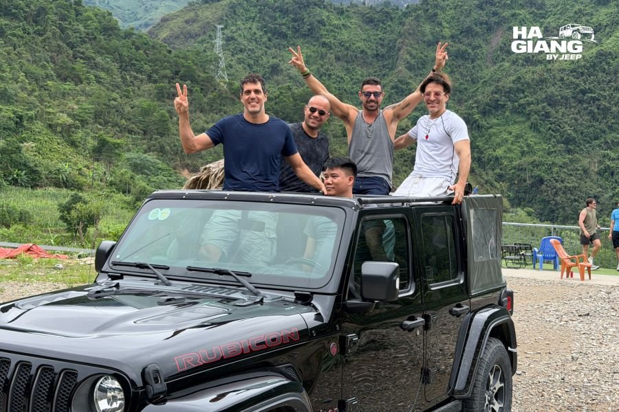
View the 6 days tourConfident drivers who want to set their own pace can take a Jeep Wrangler Rubicon rental by the day instead, though the Cao Bang route is long and we would suggest talking it through with us first so you plan realistic days.
Not sure which fits? Tell us your dates, your group and how much driving you are comfortable with, and we will tell you honestly which trip suits you, including when the answer is the shorter one. Reach us through the contact page or straight to WhatsApp.
Ban Gioc Waterfall FAQ
For travellers who enjoy landscape and quiet countryside, yes. It is the widest waterfall in Vietnam, set in a limestone valley on the Chinese border, and the surrounding Cao Bang valleys are as good as the falls themselves. It is a poor choice as a rushed day trip and an excellent one as the far point of a longer journey.
Late September and October is the strongest all round window, with high water still flowing and golden rice in the valleys. August gives maximum volume, while November through February gives clear jade water, thinner crowds and a narrower waterfall.
It sits in Trung Khanh district, Cao Bang province, beyond the provincial capital in the far northeast. Realistically it is a full travel day from Hanoi in either direction. We avoid publishing exact timings because roadworks and weather change them constantly.
No. Swimming is not permitted, and the currents below the tiers are strong. The way to get close to the water is the bamboo raft trip from the Vietnamese bank, which runs when river conditions allow.
Carry your passport, as this is a border area and identification can be checked. Registration and permit requirements vary by district and do change, so verify them close to your travel dates. We handle the current paperwork for guests on our trips.
The opposite bank is in China and subject to Chinese entry rules. Cross border tourism arrangements have been trialled and revised over the years, so treat any advice about combined visits as potentially out of date and check the latest updates before planning around it.
Yes. The main viewing lawn is flat and reached on an easy path, which makes it one of the more accessible major sights in the north. The pagoda viewpoint and Nguom Ngao Cave involve steps, so those parts are optional depending on mobility.
Allow a couple of unhurried hours for the lawn, the river bank and a raft trip if it is running, plus extra time for the pagoda above. Most guests are happiest with a half day at the falls and the rest of the day in the surrounding valleys and at Nguom Ngao Cave.
Yes, there is a ticket for the waterfall site, and the raft trip and Nguom Ngao Cave are charged separately. Prices are adjusted from time to time, so we do not publish figures. Bring cash in small notes, since card payment is limited out here.
Options range from homestays in the villages around Trung Khanh and the Quay Son valley to hotels in Cao Bang City and a small number of resorts close to Ban Gioc Waterfall. Staying near the falls lets you arrive early, which is the single best thing you can do for your visit.
Yes, and it is the way we recommend seeing it. Our 5 days and 6 days trips run the Ha Giang Loop first, then continue east through the Cao Bang geopark to Ban Gioc Waterfall, so you cross two UNESCO Global Geoparks without doubling back to Hanoi.
A rain layer in any season, warm clothing from November to February, shoes with grip for wet stone, a sealable pocket or dry bag for the raft, a lens cloth for spray, and cash in small notes. Everything else is optional.
Ready to see it for yourself?
Ban Gioc Waterfall is the finish line of our combined Ha Giang and Cao Bang journeys: private 4x4, an English speaking driver born in these mountains, permits and homestays arranged, and the freedom to stop wherever the valley looks good. Only a handful of jeeps go out each day, so dates in the golden weeks of autumn book out early.
Booking is simple: 20% upfront to prepay homestays, driver and permits, then 80% in cash when you arrive in Ha Giang.