
Ha Giang · Cao Bang · Route Guide
Ha Giang to Cao Bang: The Complete Route Guide
Most people finish the Ha Giang Loop at Meo Vac, turn around, and drive back the way they came. There is a road that keeps going east, and almost nobody takes it.
Follow that road and the landscape starts to change underneath you. The bare grey towers of the Dong Van plateau soften, then green, then round themselves into conical hills. Rivers appear where there were none. Rice replaces maize. You cross out of one UNESCO Global Geopark and, some hours later, into another.
At the far end sits Ban Gioc, a waterfall so wide it feels like a mistake in the geography, sitting directly on the border with China.
This is the Ha Giang to Cao Bang route. Here is what it actually involves.
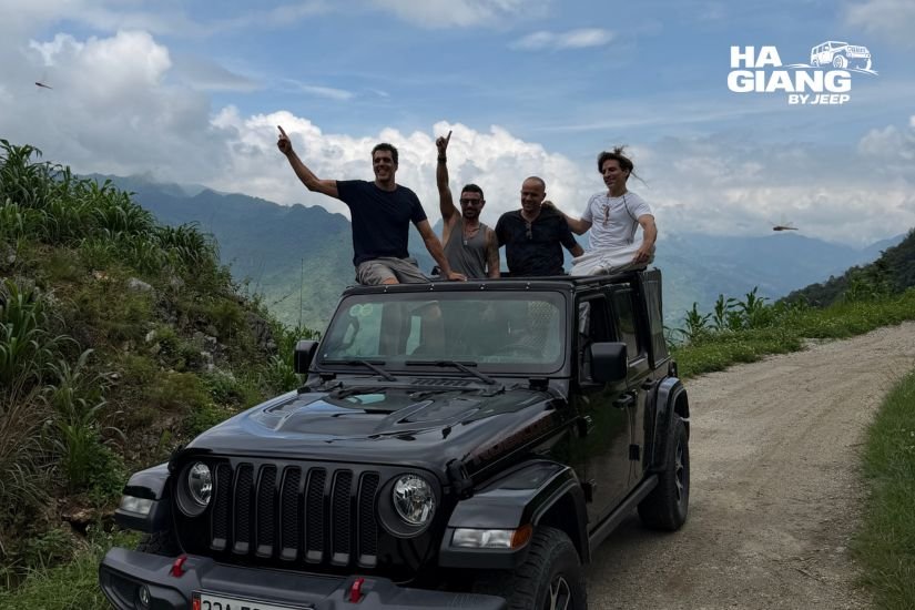
Why anyone goes from Ha Giang to Cao Bang
The honest reason is that Ha Giang is not the whole story, and a lot of people only find that out afterwards.
The loop is spectacular and it is finite. Three or four days and you have seen it, properly, and the road home from Meo Vac takes you back through country you already know. There is a moment on that return leg where you realise the trip has begun to wind down.
Going east instead means the trip keeps opening.
- A second UNESCO Global Geopark, Non Nuoc Cao Bang, entirely different in character from the Dong Van Karst Plateau. Same limestone, completely different weather, water and vegetation acting on it over a very long time.
- Ban Gioc Waterfall, which most travelers who reach it describe as the single most impressive thing they saw in the north.
- Roads that almost no tourists drive. Ha Giang is busy now. Cao Bang, in most seasons, is not.
- A trip with an ending rather than a return. You finish somewhere new instead of finishing where you started.
The trade is time. This is not a detour you bolt onto a standard loop. It is a longer trip, and it needs its own days.
Where Cao Bang actually is
Cao Bang is the province directly east of Ha Giang, in the far north, sharing the same long border. On a map the two look adjacent, and they are, in the way that two rooms separated by a mountain range are adjacent.
The provincial capital, Cao Bang City, sits in a river valley. Ban Gioc is further east from there, out toward the border. Pac Bo is to the north. God's Eye Mountain and the Ngoc Con valley sit in the country between them.
The important thing to understand is that the two regions do not look alike. People expect Cao Bang to be more of the same, and it is not.
Ha Giang is vertical, grey and bare. Limestone towers, exposed rock, maize planted in pockets of soil. It is a plateau, and it feels like one: high, hard, exposed.
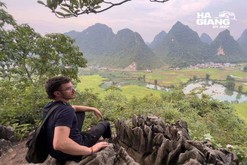
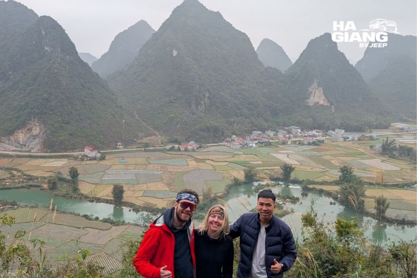
Cao Bang is green, rounded and wet. Conical hills, rivers, rice terraces, caves. It is softer country and it photographs completely differently.
Driving from one to the other in a single trip is the whole appeal. You watch a landscape become another landscape.
The road east, section by section
Leaving the plateau
The route east begins where the loop would normally turn back, past Meo Vac, and the first thing that happens is a descent. You come off the high plateau and the road drops into river country. The temperature changes. The rock stops being the main character.
This first stretch is the transition, and it is more interesting than most itineraries give it credit for. It is also the point of no return in the nicest sense: from here, you are committed to the longer trip.
The middle country
Between the two geoparks is a stretch of country that has no famous name attached to it and receives almost no visitors.
River valleys, terraced hillsides, small towns where nobody is selling anything to tourists because no tourists come. The road follows water for long sections. On a six days itinerary this is where you break the journey with a night, which is the entire argument for six days over five: instead of a single long transfer day, you get to actually be here.
We do not publish driving times for this section, and you should treat anyone who does with suspicion. Conditions on this road vary with weather and with works, and the honest answer is that it depends on the day. Ask us about your specific dates and we will give you a real picture rather than a number that makes a brochure look tidy.
Arriving into Cao Bang
You know when it happens. The hills round off. The green intensifies. The rivers get serious. Somewhere in there you have crossed into Non Nuoc Cao Bang without a sign to tell you.
Thinking about the long version?
Send us your dates and we will tell you honestly whether the Ha Giang to Cao Bang route fits your trip, and whether five days or six days makes more sense for how you travel.
What is waiting for you in Cao Bang
Ban Gioc Waterfall
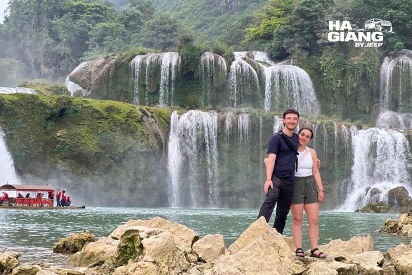
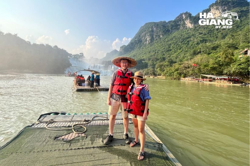
The reason most people make the journey. It is wide rather than tall, falling in tiers across a limestone shelf, with the border running through the middle of it. Bamboo rafts take visitors close to the base on the Vietnamese side. The volume of water varies a great deal through the year, so the falls in a photograph taken in one season and the falls on your day may not be the same thing at all. Ask before you build expectations. It is the sort of place that survives its own popularity: even with visitors, the scale of it does the work.
Nguom Ngao cave
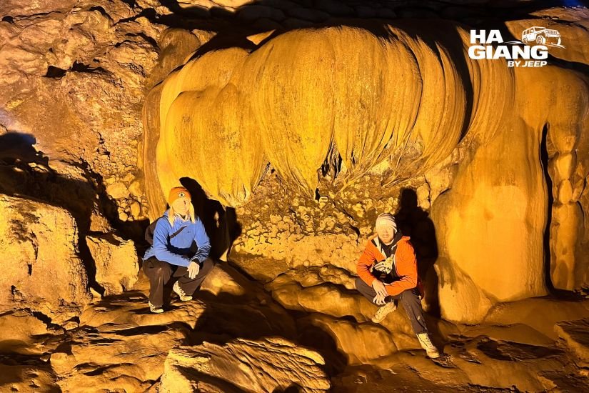
A short distance from Ban Gioc, and usually visited on the same day. A large limestone cave system, lit, walkable, and genuinely impressive rather than a filler stop. If you have any interest in why this region is a geopark, an hour underground answers the question faster than any signboard.
God's Eye Mountain
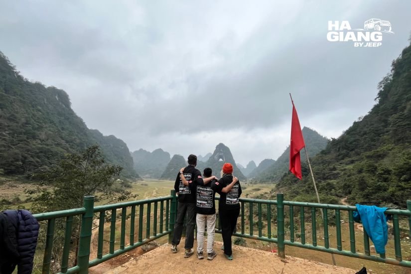
A limestone peak with a hole punched clean through it, standing above a lake that comes and goes with the season. In the dry months the lake can shrink to grassland with cattle grazing across it, which is its own kind of strange and beautiful. In the wet months it fills. One of the most photographed things in the province, and it still does not feel crowded.
The Ngoc Con valley
River, rice, limestone towers, and very little else. This is the valley people mean when they say Cao Bang is softer than Ha Giang. It is a place to drive slowly through with the roof open rather than a place with a car park and a ticket booth.
The Pac Bo historical site
For travelers whose interest in the country extends past its landscapes. A cave, a stream, and a set of places central to the modern history of Vietnam. It rewards a little reading beforehand, and it is a very different kind of stop from everything else on this route.
The 15 step pass
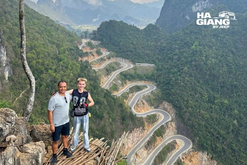
A road that stacks its switchbacks on top of each other so tightly that the whole thing reads like a diagram. It exists mainly to demonstrate that the engineers here have a sense of humour, and it is the sort of thing an open air jeep was built for.
How to travel from Ha Giang to Cao Bang
There are three realistic ways to do it, and they suit different people.
| Private jeep with a driver | Public transport | Self drive rental | |
|---|---|---|---|
| You drive? | No | No | Yes |
| Stops where you want | Yes | No | Yes |
| Reaches the small places | Yes | Rarely | Yes |
| Route can change for weather or a market | Yes | No | Only if you know the roads |
| Luggage handled | Yes | Yourself | Yourself |
| Border area paperwork | Handled for you | Yourself | Yourself |
| Suits | Families, couples, older travelers, anyone who wants the journey to be part of the trip | Independent travelers on a tight budget who do not mind losing the road between the towns | Confident drivers who want the road on their own terms |
The honest summary: public transport will move you between towns, and if the towns are what you came for, it works. But on this particular route, the towns are not the point. The country between them is. Almost everything worth stopping for on the road east has no bus stop attached to it.
That is the case for a private vehicle, and it is not a hard sell: it is a description of where the good stuff is.
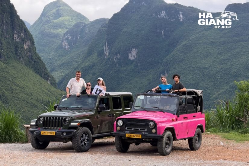
The Ha Giang and Cao Bang Jeep Tour 5 Days and the Ha Giang and Cao Bang Jeep Tour 6 Days are both private, both open air with a soft top and heating for the cold and the rain, and both driven by someone born in these mountains who speaks English and knows which valley the cloud has left.
If you would rather drive it yourself, the Jeep Wrangler Rubicon rental goes by the day. Rules and requirements for driving in Vietnam can change, so check the latest updates and speak to us before you commit to a self drive plan on this route in particular. It is long, remote in sections, and not the place to discover a paperwork problem.
How many days the route needs
Short version: five at a minimum, six to do it properly.
Five days covers Ha Giang and then Cao Bang, with the crossing between them compressed into a single long transfer. Ban Gioc, the geopark, the main sights. It works, and it is the efficient version.
Six days gives the crossing a night of its own. That means the middle country, the part of the route with no famous name, stops being a drive you endure and becomes a day you remember. It also means Cao Bang gets a proper day rather than a hurried one.
If you are choosing between them and you can afford the extra day, take six. It is the single upgrade on this route that changes the most.
Two, three and four days do not reach Cao Bang at all. That is not a limitation to work around, it is arithmetic. If you only have those, do the loop properly and come back for the east another time. We wrote about the whole duration question in our guide to how many days for the Ha Giang Loop.
You will also want to plan the journey back to Hanoi from Cao Bang, which is a separate leg and does not appear on any route map of the region. Transport options and schedules change, so check the latest updates, and ask us if you want help fitting it around a flight.
When to go
There is no single best season, only trade offs, and they matter more on this route than on the loop because you are covering two very different landscapes.
The wetter months put water in the waterfall, which is not a small consideration when the waterfall is the reason you came. Ban Gioc at volume is a different thing entirely. The cost is cloud, rain, and roads that ask for patience.
The drier, cooler months give you clearer air, easier driving, and a Ha Giang plateau at its most photogenic. Ban Gioc will have less water. God's Eye Mountain may be standing above grassland rather than a lake.
Around the harvest, the Cao Bang valleys turn gold, and the contrast with the grey of the Dong Van plateau is at its strongest.
Conditions vary year to year and this is a general shape rather than a forecast. Tell us your dates and we will tell you what that time of year usually looks like on this route.
Practical notes
- Permits and border areas. Both Ha Giang and Cao Bang have areas close to the border, and permits have historically been required in places. Rules can change and enforcement can change with them, so do not treat anything you read online, including this, as final. We handle the border area paperwork from our office in Ha Giang City. Bring your passport and keep it with you.
- Cash. Useful, particularly in the smaller places and at the markets. Do not assume a card will work outside the main towns.
- Signal. Present across most of the route, absent in places. Download an offline map before you leave.
- Cold. Both regions get colder than travelers expect, and the plateau especially so. The jeeps have a soft top and heating, so the driving is comfortable. Standing at a viewpoint in a mountain wind is where the cold finds you. Bring a real jacket.
- Distances. Long. Longer than the map suggests, for the usual reason: the road climbs.
What you eat along the way
The food changes as the landscape does, and it is worth paying attention to.
On the Ha Giang side, the plateau classics. Banh cuon trung, steamed rice rolls with egg, served here with a bowl of hot broth rather than a dipping sauce. Com lam, sticky rice cooked inside bamboo over a fire. Thang den in Dong Van after dark, warm rice balls in ginger syrup, which is precisely what you want when the temperature falls. Chao au tau, thick and faintly bitter, made from a local tuber, an evening dish. And ruou ngo, corn wine, which somebody will pour for you.
On the Cao Bang side, the cooking follows the water and the rice, and the roadside places are quieter and less used to visitors, which usually means better.
Here is the part that matters for planning. With a private jeep and a driver, none of the eating is a logistics problem. You stop at the stall that smells right. You sit down at a market because a woman is ladling something out of a pot and you want to know what it is. You accept the corn wine at the homestay, because you are not the one driving in the morning.
On a route this long and this remote, that freedom is not a luxury. It is most of what makes the days good.
Mistakes people make on this route
- Treating Cao Bang as a day trip from Ha Giang. It is not. It is a different region and it needs its own days.
- Booking five days and expecting six days of experience. Five works. It also means the crossing is a long transfer. Know which one you are buying.
- Planning around a photograph of Ban Gioc without checking the season. The water volume varies enormously. Ask.
- Assuming the return to Hanoi is trivial. It is a separate leg from a different city, and it needs planning around your flight.
- Trusting driving times you found online. Nobody can give you those honestly, including us.
- Leaving the paperwork to chance. Border areas, permits, rules that change. Let an operator based in the region handle it.
- Booking too late. Jeep availability is limited and the long itineraries fill first, because they are the ones people plan trips around. Once you have a confirmed date, book as soon as you reasonably can. Most guests book one to three months ahead.
Which jeep tour is right for you?
6 days if you want this route done properly. The Ha Giang and Cao Bang Jeep Tour 6 Days gives the crossing a night of its own and gives Cao Bang a real day. Two UNESCO Global Geoparks, one continuous drive, ending at Ban Gioc rather than back where you started. If the north of Vietnam is why you came to the country, this is the trip.
5 days if you want Cao Bang but have one day fewer. The Ha Giang and Cao Bang Jeep Tour 5 Days covers the same ground with the crossing compressed into a single transfer day. Efficient, and still a very long way from an ordinary trip.
4 days if Cao Bang is out of reach this time. The Ha Giang Loop Jeep Tour 4 Days is the full loop with Du Gia and the villages, unhurried.
3 days if your schedule is tight. The Ha Giang Loop Jeep Tour 3 Days is the classic route at a sensible pace.
The rental if you are a confident driver. The Jeep Wrangler Rubicon rental goes by the day, with route advice from people who drive these roads for a living.
If you want to know what a day in the vehicle actually feels like before committing to six of them, we broke it down in our guide to what to expect on a Ha Giang jeep tour.
Ready to drive east?
Every jeep is private. You are never grouped with strangers. Your driver was born in these mountains, speaks English, and has driven this road in every season it has.
We are based in Ha Giang City, we are on WhatsApp 24 hours a day, and we handle the border area paperwork for both provinces so you do not have to think about it. Tell us your dates and we will tell you honestly whether the route fits, and whether five days or six is right for you.
booking@hagiangbyjeep.com · +84 862 379 288 · +84 938 988 593
FAQ
The route runs east from Meo Vac, off the Dong Van plateau, through river country, and into the Non Nuoc Cao Bang geopark. A private jeep with a driver is the way to actually see it, since almost everything worth stopping for on the road east has no bus stop attached to it. Public transport will move you between the towns.
Five at a minimum, six to do it properly. Five days compresses the crossing into one long transfer. Six days gives that crossing a night of its own and gives Cao Bang a real day rather than a hurried one.
No. Ban Gioc sits in Cao Bang, well east of Meo Vac, and it cannot be added to a two, three or four days loop. It needs the five or six days combo itinerary.
They are neighbours and they look nothing alike. Ha Giang is a high, bare, grey limestone plateau. Cao Bang is green, rounded and wet: conical hills, rivers, rice, caves. Driving from one to the other in a single trip is the whole appeal.
The wetter months put far more water in the falls, which changes the experience completely. The drier months give clearer air and easier driving but a thinner waterfall. Neither is wrong, and conditions vary year to year, so ask us about your specific dates.
Parts of both provinces sit close to the border and permits have historically been required in places. Rules can change, so do not rely on secondhand information. We handle the border area paperwork from our office in Ha Giang City. Bring your passport.
A limestone peak with a hole punched straight through it, standing above a lake that fills and empties with the season. In the dry months the lake can shrink to grassland with cattle grazing on it. It sits within the Non Nuoc Cao Bang geopark.
It is a separate leg, from a different city than the one you started in, and it needs planning around your flight. Options and schedules change, so check the latest updates and ask us if you want help fitting it together.
Yes, and the six days version more so than the five. You sit in a proper seat, the cabin closes and heats when the weather turns, and you step out at the stops. The one thing to be honest about is that this is a long route, so the extra day matters more here than anywhere else.
Yes, if you are a confident driver. The Wrangler Rubicon rental goes by the day and we will brief you on the route. This road is long and remote in sections, so requirements and paperwork matter more than usual. Rules can change, so check the latest updates and talk to us first.